Lakes Jāša – Cirišs HPP reservoir
Lakes Jāša – Cirišs HPP reservoir
[nggallery id=6]
View Gallery
View Gallery
Around the lakes Sivers and Drīdzs
[nggallery id=5]
Around Lake Lubāns
[nggallery id=4]
Around the lake Rušons
[nggallery id=3]
Read More
Read More
Unfortunately nothing was found
Unfortunately nothing was found
Lake Drīdzis – Jazinks
[nggallery id=1]
Upper course of the river Dubna
[nggallery id=2]
Upper course of the river Dubna from the lake Sivers to lake Lukna
“Upper course of the river Dubna from the lake Sivers to lake Lukna-50 km”
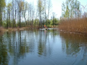 Dubna is the longest river of Latgale. It begins and ends in Latgale. The river Dubna streams out of the lake Sivers, the ninth largest lake in Latvia. Although in some materials the lake Cārmins is considered to be the source of the river Dubna, but we support the opinion that Dubna streams out of the lake Sivers. Also the local inhabitants call the nullah connecting the lakes Sivers with Ārdavs and Ārdavs (Ploteņu) with Lejas ezers as the river Dubna.
Dubna is the right affluent of middle reaches of the river Daugava and it is the second longest affluent of the river Daugava in the territory of Latvia. Longer is only the river Ogre -188 km. Length of Dubna is 120 km, slope is 76 m, area of basin is 2780 km2, the average flow rate in the entry: annually 16,7 cumecs, during high water 112 cumecs. For tourism it can be used all the season from the lake Višķi, but in low water level it could be problematic to move from the source to entry in the lake Višķi. In the upper course to the lake Višķi you have to count with frequent obstacles of fallen trees and spans with low water. The way is obstructed also by the small hydroelectric power stations that are four within this span, two mill sluices and one embankment.
In the upper course when flowing through the Highlands of Latgale, Dubna is rapid, riffles interchange there with slower spans. Although more to be more precise it must be said that is was rapid because after 2000 the most beautiful and rapid spans of the river were deluged when building the small hydroelectric power stations. Before they were built water mill ruins and remains from sluices had survived here in place of what the mentioned hydroelectric power stations were built. Here, in the not deluged spans of river, its width reaches ca. 10-15 m.
Behind the lakes Višķi and Lukna the river Dubna flows through the plain Jersika. Here the river grows wider and deeper. The width reaches 15-20 m. Here the riverside is low so the meadows and arable land adjacent to the river was flooded in springs. Already in the thirtieth the government of Latvia financed one of the greatest that time land amelioration measures and controlled the span of the river in the length of 61,6 km. During the Soviet times a 614 ha big polder with pump station and 2.3 km long protecting dike was built in Pelēči parish. It must be mentioned that currently the area of polder begins to overgrow with shrubs and the draining systems begin to crash. In the result of ameliorative measures there are many dead arms of the river on the sides of Dubna, particularly in the span from Špoģi – Preiļi road bridge to Arendole and Vecvārkava (Upmala). The biggest right-side affluent are Feimanka, Oša, Jaša, Šusta, Divkle and Egļupe, but on the left-side -Kalupe, Malnaviņa, Kucupe and Bērzupe. The right-side affluent are much longer than the ones of the left-side because the left-side river flow directly in the river Daugava. The longest right-side affluent Feimanka (72 km) is more then two times as long as the longest left-side affluent Kalupe (32 km).
In the upper course Dubna frequently flows through a wood. The biggest wood area that is crossed by Dubna in this span is from Staškeviči to Lauku Ļāperi.
The surroundings of Dubna in whole span from Špoģi to Līvāni can be agriculturally used and wood areas aren’t directly adjacent to its sides. Usually the sides are overgrown with shrubs – osiers, willows, alders, bird-cherry trees, etc. Just in Arendole the beautiful Arendole estate park with centenarian trees is adjacent to the very river.
Behind the Rožupe the river Dubna grows wider and the width thereof reaches on average 20-25 m. It is connected with the fact that two biggest affluent- Oša and Feimanka flow into the river Dubna in a short span. At Rožupe there is hydropost where the hydrographical measurements are made. Since in summers the river Dubna badly overgrows, particularly behind Rožupe, then in 2009 this span of river was deepened. The aim of deepening was to facilitate more rapid water flow rate expecting that it shall decrease the overgrowing of the river with waterweeds. Before Līvāni several small islands appear in the river Dubna where in springs ice jams form. In Līvāni in 2001 the Straumes HPP was renewed. Behind the HPP, before the entry in Daugava the river Dubna forms a quite branched delta that sharply turns from west northwards. Further more detailed description of the route of upper course of the river Dubna.
We begin the route at effluent of the river Dubna from the lake Sivers. To get there we have to go to Kombuļi and then turn on the Kombuļi-Auleja road and ca. after 7 km we shall cross the bridge over Dubna. On the first turn after the bridge at the road with the sign to Vanagi we turn right and after 1,5 km we turn again right and arrive at the margin of the lake. The mound on the left side is Brāslava castle mound. Getting at the margin of the lake should be agreed with the landowner from the nearby house.
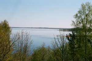 Before getting into boats we must definitely go onto the Brāslava castle mound. From the top of the castle mound we can see fantastic panoramas on the lake Sivers and the Highlands of Latgale. On the top of the castle mound the local inhabitants celebrate Midsummer Day and here is the place for Ligo bonfire. Now we can begin our route.
By the river Dubna we go to the lake Ārdavs. Arriving in the lake Ārdavs along the right margin we go westwards to the overgrown lake Ploteņš. Here the opinion of cartographers and geographers differ–whether Ploteņš is a separate lake or just a creek of the lake Ārdavs? However it may be, in the latest cartography materials Ploteņš appear and we shall regard it as a separate lake, although when entering it we shall see that all around there are only reed and water-plants among that there is a few metres wide free water zone that in 800 m grows into the river Dubna. Having gone another ca. 450 m we arrive at Kombuļi-Auleja road bridge. Totally in the route we have covered 3,7 km.
Behind the bridge we have to make another 750 m by the river Dubna and then we arrive at the lake Lejs. At the entry of Dubna in the lake there is a nice resting-place that is managed by the owners of 350 m distant guest house “Lejasmalas”.
Lejs or the lake Lejas is located in winding subglacial shallows between the lakes Ārdavs and Cārminis. The lake bed has a wide south part (arriving into the lake from the river Dubna it remains on the left from us) and a wedge-formed bottleneck on the north-west (in this direction we must continue the route). The lake has three depths – 30,7 m in the south part, 34 m opposite the eastern bank, it is the deepest place of the lake, and 15 m at the south-east end. The average depth is 8,2 m. Lejs is the tenth deepest lake in Latvia. The area of the lake is 177 ha, together with the islands – 178 ha.
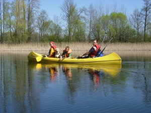 In the place where the widest south part of the lake gets into the narrower north-west part there are two islands that can be went round by the east or west side. We continue the route north-westwards – the lake becomes narrower and narrower till at the end of the reck we arrive at the source of the river Dubna and entry in the lake Cārmins. Here is also a bridge. In the route we have covered 6,1 km.
Cārmins (Cārmans) is the next lake in our route. Its area is 222 ha, together with the only island 224 ha. The length of the lake reaches 5,6 km, but the width 0,6 km. The average depth is 9,3 m, but maximum depth – 30,6 m. Cārmins is one of the picturesque deep and large lakes in the undulating ground of Dagda. The lake is of subglacial origin, the shallows bent north-westwards and south-eastwards. The banks are sheer and overgrown so particularly beautiful landscapes can be seen in spring and nice autumn days. The lake has many creeks and recks. The deepest part of the lake is in the north part. Immediately after the two only islands of the lake on the left side the river Dubna sluices. In some materials it is said that this is the real source of the river Dubna, but as it frequently happens, opinions about the sources of rivers differ. To protect the beautiful landscapes and frogbit family plants, in 2004 Cārmaņa lake country park was established on the banks of the lake Cārmins with the area of 529 ha.
When entering the lake Cārmins we go initially along the left margin westwards. Gradually the route turns northwards. Ahead we can see two islands behind that there is the mentioned source of the river Dubna. After 1,7 km we reach the source of Dubna. The source has hid in shrubs opposite the smallest island that is located more on the north.
After 450 m we reach delta creek of the lake Zosns that in summer usually overgrows. After another 400 m we go into the lake Zosns. The are of the lake Zosns is 18 ha, the average depth 2,0 m, but maximum depth reaches 3,0 m. Here we keep at the left margin because the source of Dubna is on the west of the lake. After short 0,6 km we arrive at remains of a bridge. Once here was a pedestrian bridge but now only separate wooden poles are left over that there has been a footbridge. During low water this place is used as a ford. The riverbed here is comparatively wide in places more than 30 m, but it is overgrown with reed and other water-plants. Behind the remains of the bridge after 500 m three culverts are placed in the river and dike is made over them over that gravel is taken from the pit that we can see on the left bank. The gravel-pit was created in 2010. Here we’ll have to pull the boats over the dike. Soon after the dike the river comes closer to the Krāslava-Aglona motorway. In this place the river sharply turns southwards and continues to flow parallel to the motorway. After 1,0 km we reach Sakova mill-lake and the bridge over the dike connecting Aizupes with Krāslava-Aglona motorway. Also here we’ll have to carry the boats over the dike. After 0,3 km we reach the bridge of the motorway over the river Dubna. Totally in the route we have covered 9,4 km.
Behind the bridge after 290 m we float in the lake Sakova. Area of the lake Sakova is 22 ha, the average depth is 1,8 m, but maximum depth 2,0m. In the lake Sakova we keep closer to the north margin because the source of Dubna is located in the north-west part of the lake in the place where close to the margin houses can be seen. About the middle of the lake on the left from us we can see the only island of the lake.
When further traversing the lake the river Dubna mainly cranks through a wood till after 2,3 km we reach Kovaļova millpond. By the flux we go another 260 m and reach the mill dike. Here we’ll have to carry the boats. When going ashore ca. after 150 metres we can see the blue-green Kovaļova old-believer preaching-house. At the same time we can go to see it. The chapel was built in 1861. Here it is possible to order an excursion with narration about traditions of old-believers and icon-painting but during the visit you must observe the custom of old-believers-women must wear a kerchief and long skirts, men – long trousers. Excursions can be ordered by the phone 65646278.
Having seen the chapel we board and continue the route. Although in straight direction there are ca. 300 m to the Šķeltova-Grāveri road bridge, by the river the distance reaches almost one kilometre-980 m. At this bridge we have covered 13,3 km in the route.
Further for 3 km the river Dubna snakes through meadows overgrown with shrubs in parallel to Šķeltova-Grāveri road. The average distance from the river to the road is 150-350 m. After 3 km the river discharges into the lake Aksenova. The lake Aksenova with its six islands is one of the most picturesque small lakes in our tour. In some materials a fact appears that there are seven islands in the lake. Some day perhaps it was so, but the biggest island has merged with the smaller island on the north and now it is practically one island. Area of the lake Aksenova (Aksjonova, Aņisimova, Savičs) is 1,25 km2, together with the island 1,32 km2. The average depth is 3,5 m, maximum depth 9,4 m. In the north banks are low, in the south-sheer and picturesque. Length of coastline reaches 5,5 km. Area of the biggest island is 5,1 ha. Lake bed in the south-west part 7-9,4 m deep, coastline sandy, in greater depth there is mud.
We have to keep in the middle of the islands to find the source of the river Dubna from the lake. We must look for the source of the river Dubna opposite the second island on the left side. Over the lake we must have covered 1,55 km and after another 300 m we reach the Grāveri-Aksenova-Šķeltova road bridge. Totally we have covered 18,1 km. If there is a wish to stretch the legs it is possible to go to 1 km distant Peipiņi Catholic Church. In this case you have to go southwards the road. From the road there is a beautiful view on the just traversed lake Aksenova. From the church you also can see the lake Peipiņi. Peipiņi parish was established after the First World War and the first dean was Jānis Ziemelis. For a country parish relatively big corner-jointed chapel with two towers was built in 1926 at expenses of parishioners. In 1931 the dean Jāzeps Ļakse put a lead roof on Peipiņi, built the towers with a high spire and covered with lead. In 1935 the church was planked and painted. From 1955 to 1972 the dean D. Punculis took out the beams and immured bricks instead, iron fence was put around the church and gates in concrete posts. In 1955 the dean Staņislavs Svilāns built a parsonage behind the church opposite the presbytery. The church was called the Church of Virgin Mary – Mother of Pains. In 2002 Peipiņi Church was included in project of list of national protected cultural monuments. Art objects are located in the church that in 2001 were included in the project of lists of protected monuments – church ceiling lantern, sconces, and reliquary.
Behind the bridge after 1,2 km we arrive at Upes Kudiņu water mill, there is a facilitated resting and tent place. Staying must be agreed by phone 29734566. Here is no dike and the tour can be continued without carrying of boats. On the right side there are houses and right there in the wood there is Brīver castle mound. In 1941 the castle mound was discovered and wider described by A. Gusars.
Timbered Brīveri castle mound is established on ca. 15 m high left bank of the river Dubna, where forming 8 m deep glen a brooklet flows into the river. Thus a land corner has formed that in north, east and south-east has the sheer brook glen descent, but in south and south-west the sheer riverside of Dubna. On north-west where there are no natural obstacles the castle mound is delimited from surroundings with a 45 m long, 5 m wide and 1 m high dam. In front of the dam at the descent of glen possibly remains of the second ditch are to be observed –the ditch itself in the front of the castle mound is ploughed up. Inside of the dam there is 8 m wide and 0,5 m deep ditch delimitating a flat area of 35×40 m. On the side of the plateau against the ditch once there was a soft 0,2-0,3 m high bank that nowadays cannot be seen anymore. More than 0,4 m thick cultural layer was found in the plateau of the castle mound that has formed in the soil of light sand. Chippings of handmade smooth plates were found there that could testify that the castle mound is to be referable to I millenary A.D.
Behind the Upes Kudiņu mills having covered 3 km we reach the next bridge. This time it is Aglona-Šķeltova road bridge. From the beginning of the route we have made 22,35 km.
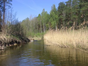 1,3 km after the road we reach Staškeviči HPP reservoir, after another 0,5 km on the left side there is the place where Dubna bight branches. This bight is dug over and the river bed is straightened out. In the middle of the straightened span there is Staškeviči HPP dike. Till the dike there are another 250 m, but also behind the dike the straightened span continues for another 250 m. In this point from the left side the natural bed of Dubna joins again. More extreme tourists can try to bypass the HPP by the old bed, but you have to count that the water level here is lower than in the straightened span. This bight of Dubna is 3 km long and we don’t count it in the total length of the route.
After this juncture further 7,0 km Dubna flows through the biggest wood area and the least populated span in whole route. There are also no somewhat remarkable roads in this span. Part of this span Dubna is boundary river between Aglona and Daugavpils counties. After these 7,0 km we have arrived at a small wooden bridge. After a longer period on both riversides we can see houses. Ca. 50 m after the bridge we reach a bight where part of the river flows again straight, but part on the left and makes a bight that after 520 m joins again with the straight span. The straight span is 150 m long. From this juncture having covered ca. 0.5 km there is Ļāperi castle mound on the left bank in the wood. The first person who investigated and described Ļāperi castle mound was Ernests Brastiņš, the famous ancient times investigator of the first Latvia. He was the first person who starting from 1922 every summer visited and investigated the castle mounds of Latvia, as a result of what he published four books about the castle mounds of Latvia. Every book was devoted to one region of Latvia and to the castle mounds investigated in this region. Book about the castle mounds of Latgale was published in 1928. Here is also the description about Ļāperi castle mound, and also about further Greita hill and Baranovska castle mound.
Ļāperu castle mound is a solitary round hill that rises 28 m above the level of Dubna. The hill has a small slightly explicit round plateau with diameter of ca. 35 m. Two meters lower than the edge of the plateau all around the hill at places you can see a terrace. Another terrace is located some meters lower than the firs one. Both these terraces are weekly remained because in former times the hill was ploughed. The soil of castle mound consists of fine-grained sand where a coniferous forest grows that has already taken over the entire castle mound.
Several stories go about the Ļāperi castle mound. One of them is about a virgin who has lived in the hill. She was imprisoned there and she wanted to get away from the hill. Once she came out and asked the people for beads, so she shall become free again. The beads must be particular-they have to be two and equal. If the virgin would receive such beads, she would get out of the castle mound. Such beads weren’t found and the virgin had to stay in the castle mound. It is said that she still lives there.
Another story goes that a nobleman had lived inside the hill who guarded his property there. Once during the war he had taken his possessions and put in the carriage and gone away. The carriage was set to two black horses. The horses had dragged the nobleman with all hid possession in the lake at the foot of the hill. It is said that the lake is now overgrown.
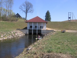 When continuing the route after 2.2 km we reach Šķīvišķi HPP reservoir. Having gone ca. 1,5 km by the reservoir we arrive at the next castle mound –Greita hill. The origin of the name “Greita hill” is explained differently. One of the versions is that the name has originated from a fabulous enormous virgin Grieta who was buried in the hill fill; another version is that “Greida” is the same as bank, fill, Russian “grjada”. According to the opinion of Ernests Brastiņ’s this explanation seems acceptable because the castle mound really is characterized by ca. 70 m long straight fill. Dubna encloses the 30 m high castle mound from three sides. A wide ditch was made at the side not protected from the river from the bottom of that to the hill there are 9-10 m. At the moment the castle mound is overgrown with wood. About the Greita hill there goes also a story. Once in the evening village people have seen that a gate was opened in the castle mound. Bright light have shone in the gates. Slim woman had stood in the light and next to her black dogs. After a moment the gate had closed again and the brightness had disappeared.
After another 0,9 km we arrive at HPP dike. Šķīvišķi HPP was built in 2001. It is the upper HPP of cascade, underneath there is Dubeņeca HPP, behind it-Galvāni HPP. HPP complex consists of massive ferroconcrete foundation, on that there is turbine chamber erected from metal constructions and generator room with flat-belt drive and above them container-type structure with electric accessories equipment. This and also the other two hydroelectric power stations are managed by SIA Novators. Totally in the route we have covered 37,0 km.
0.6 km behind the Šķīvišķi HPP begins Dubeņeca HPP reservoir and after another 0.74 km we reach HPP dike. Dubeņeca HPP is the second one in this cascade, but the first one who was built in 2000.
0.47 km behind Dubeņeca HPP dike begins the third and the last HPP reservoir. This is Galvāni HPP that was built in a new place in 2001 and is with the least power. If the power of both previous HPPs is 450-500 kW for each, then the power of Galvāni HPP is half as big -250 kW.
In summers there have been cases when a completely small rivulet flows behind the dike of this HPP that can encumber further movement of water tourists. If you’re lucky to arrive at the HPP at midday, there is hope that the sluice shall be opened and the water level shall be sufficient to continue normally the route. Usually opening of sluice is from 1-2 p.m.
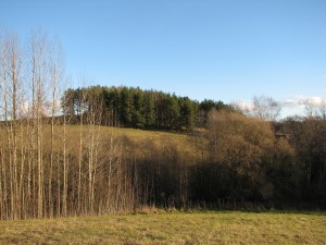 Opposite the dike on the right bank you can see Baranovska castle hill that is overgrown with wood, although in twentieth – thirties of the last century the hill wasn’t overgrown and it was agriculturally cultivated. Just as with the two previous castle hills, Ernests Brastiņš was the first person who investigated and described this castle mound.
According to the looks, the castle mound is a solitary small hill with 7-10 m high step sides. It is located in the coomb of other hills and for an ignoramus it is difficult to see and distinguish among other ambient hills. Sides of the hill already naturally have been steep enough so additional fills and other work isn’t done. Since the castle mound was ploughed for ages then the occupation layer is badly preserved. Length of plateau is ca. 50 m, but the width is half as long. Perhaps the castle mound was populated already during the Stone Age. A story goes that golden money is buried in the castle hill and it is possible to dig the money only at Midsummer night. In former time there was no Midsummer night when local people wouldn’t have searched for this buried golden money.
Behind Galvāna HPP dike after short 0.5 km we reach Ambeļi-Aglona road bridge. When going along the road southwards after short kilometre it is possible to get to Ambeļi.
In Ambeļi you can see the small Catholic Church that was built in 1888 and Ambeļi park. Area of the park is 6,2 ha, its arrangement was begun at the end of 18th century, later it was restored according to the project of G. Kūfalts. It is a beautiful landscape park between two hillocks, in the valley there is a pond with Love island. 38 exotic plant species grow in the park.
When returning at Dubna we continue the route. Behind the bridge after 2.7 km we reach the lake Višķi. Totally in the route we have covered 42.5 km.
When arriving at the lake Višķi we finally don’t have to worry about fallen trees and other obstacles.
The lake Višķi is located 99,3 m above sea level. Its area is 3,60 km2. Length – 2,6 km, maximum width 1,9 km, just a narrow road belt separates from the lake Lukna. Still in the fiftieth of the 20th century the lake Višķi was connected with the lake Dodka that now is separated one from another by a marshy constriction. Banks of the lake Višķi are flat or low, in places steep. The coastline is indented by several peninsulas thus forming a convoluted three-inlet reservoir that grows narrow at the north-east end. Višķi castle mound can be visited on the peninsula at the north-east end. Here is also good bathing ground and overnight stay place. Further there is the guest house “Višķezers” at the very north end of the lake where you can comfortably stay overnight and if necessary agree on leaving the car.
Having arrived in the lake we move westward against the closes bank that is the largest peninsula of the lake. Further we continue the way along the peninsula till we see the bridge over Dubna on Višķi-Aglona motorway. This span of Dubna connects the lakes Višķi and Lukna. If you don’t want to continue the route here is a convenient place where to land and end the tour. Tour over the lake is 2 km long. Till the bridge totally we have covered 44.5 km.
When entering the lake Lukna we keep at right and go to the 450 m distant resting-place at the south-east end of the lake. It is not advisable to plan to stay overnight here because at weekends in good weather loud companies usually arrive here. However, it is advisable to stop here and climb onto the bird observation tower. From there you can see wonderful views – the majestic Višķi Catholic Church, the lake Višķi, lakes Boltari and Ostrova at the foot and of course the Lake Lukna with its creeks and ambient hillocks. Here also you can end the planned tour because it is convenient to land here and drive up with the transport is also no problem.
Area of the lake Lukna is bigger that of the lake Višķ and makes 4.09 km2. Maximum length reaches 5.3 km, width in north-west part-1.6 km. Average depth of the lake is 2.4 m, but maximum depth 6.1 m.
Banks of the lake Lukna are flat. East bank is firm, but other banks are miry, overgrown with shrubs. The lake is rich with creeks. North-west part is wider, in the middle there is contraction, East part is wider again, but not as wide as the north-west part. The middle contraction is also the deepest place of the lake. Coastline is 18.5 km long.
Further we continue the route by the lake Lukna westward. The left bank of the lake Lukna is densely populated. Višķi, Višķi technical college and Špoģi are located here. Višķi Catholic Church built from the split boulders looks wonderful from the lake. On the right bank we can notice Daniševska old-believers preaching house and Maskovskaja Orthodox church that are close by one another.
Having gone ca. 4 km by the lake Lukna we arrive at the contraction of Dubna source. After another 1.6 km we arrive at Daugavpils-Rēzekne motorway bridge. Here end the first part of our tour. We have arrived at Špoģi village that is the centre of Višķi parish with parish administrative building, schools and stores. Not far from the bridge you can visit Second World War warrior’s cemetery.
Totally in the route we have covered 50.5 km.
It is advisable to take this route in spring because then the water level is higher and the river is easier to pass. Frequently there are fallen trees in the route that can be overcome by pulling or carrying the boats. This roué is meant for tourists who are not afraid of certain difficulties and inconveniences, however unexpected adventures and adrenaline are guaranteed in this route, as well as satisfaction at the moment when you’ll have made the route. Later for year in other tours you shall remember and tell about the adventures of this tour.
Lakes Drīdzs – Jazinks
“Drīdzs-Ots-Ārdavs-Sivers-Ploteņš-Lejs-Cārmins-Jazinks-32 km”
Most convenient it is to begin the route at the recreation centre “Dridži” that is located at the east end of the lake Drīdzs, ca. 2 km from Skaista. But Skaista is located 16 km from Krāslava when going along the motorway Krāslava – Dagda – Rēzekne.
 In the recreation centre for definite pay it is possible to leave the car and if necessary to stay overnight. The centre is guarded so the cars will be in safe keeping.
Drīdzs is the deepest lake not only in Latvia, but also in the Baltic States. The average depth is 12,8 m, but according to latest measurements the deepest point reaches 63,1 m. (Mainly the depth of 65,1 m appears in different materials). Physiogeographically the lake Drīdzs and other lakes in the route are located in the hillock Dagda of the Highlands Latgale. It has formed in subglacial bed so the lakebed sometimes looks like large, winding and wide river.
Areal of the lake Drīdzs is 753 ha (with islands 772 ha), length 9,8 km, the widest part is located o the West and reaches 2,4 km. There are nine islands in the lake – the biggest one is the island Bernata (Bernāta) with area of 13,9 ha, the other islands are quite small.
In 1938 the Latvian hydrobiologist Bruno Bērziņš (1909-1985) stated in the middle of the lake Drīdzs the biggest depth of Latvian lakes. In 1939, when making measurements from ice, 1681 depth measurements were made and a detailed depth map was prepared. Water exchange takes places only once in 12,5 years, water brings a bit of nutrients. When compared with information from 1939, the amount of oxygen has decreased significantly in the deepest water sheets, in some creeks at the depth of 8 m it is not at all. It creates flowering caused by cyanobacteria that is disliked by the living beings of the lake.
In 1977 the complex nature restricted area was formed around the lake Drīdzs with the area of 2520 ha. In 1999 the nature restricted area was changed into country park of the lake Drīdzs. Its task is to preserve and protect the landscape of lakes and hillocks characteristic to the south part of the Highlands Latgale.
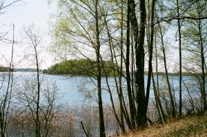 At the beginning of the route there is really a feeling that we tour along a big river. Having covered ca. 3 km we reach the creek Šaure that is on the right from us. We have to continue the route a bit on left. When going in this direction we shall se the island Bernata (Bernāta). There is the hill Baterija on the right bank of the lake at the end of peninsula opposite the island Bernata (Bernāta). In fact, the hill Baterija is a castle mound. To the hill Baterija we have managed 5,6 km. Here it is convenient to land with boats and go ashore.
Further we move along the reck between the bank and the island Bernata (Bernāta). Behind the reck the lake Drīdzs grows wider. This is the widest part of the lake in our route that north-westward becomes ever narrower. We approach the hill Sauleskalns. The narrow creek before the hill Sauleskalns is called the foot of the lake Drīdzs.
After 9,1 km we have reached the recreation centre of Sauleskalns. The origin of the recreation centre is to be searched already in Soviet times. The hill Sauleskalns itself is a cult place of the ancient Latgallians. The head of hill rises 210 m above sea level (according to other information 211m above sea level), relative height exceeds 50 m. In clear weather here you can see great panorama from the Highland of Latgale on the mirrors of the many lakes and creeks. It is said that 27 lakes can be seen in clear weather. If separately seen creeks of one lake are also counted then there are even more!
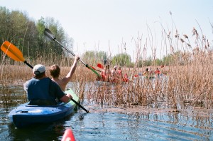 After seeing the hill Sauleskalns we board in the boats and go back. We try to keep closer to the left bank because after ca. 2,2 km there shall be a flow connecting the lakes Drīdzs and Ots. When reaching the flow we have managed totally 11,3 km. In fact, this is not just a flow but a channel. The channel was dug in the twentieth of the 20th century and it decreased the level of the lake Drīdzs for 0,5m. When the water level is higher the water from the lake Drīdzs flow to the lake Ots, and there are no problems to go through the channel by boats. More difficult it could be in summers when the water level is lower. Length of channel is ca. 250 m and at the end of the lake Ots it is quite strongly overgrown with reed. Having traversed the channel we arrive in the lake Ots.
Area of the lake Ots (Ats) is 120 ha, together with the four islands – 124 ha. Average depth of the lake is 2,4 m, but maximum depth reaches 7,4 m. Length west-eastward is 1,9 km, but maximum width reaches 1,1 km. the lake has seasonal water supply through the channel from the lake Drīdzs, and also from the amelioration ditches. Eutrophic lake. By pining-up of mud, since the fiftieth the depth of the lake has decreased for ca. 1 m. That is why here is more fish than in the proximal lake Drīdzs.
Having entered the lake Ots we keep to the left. Having bypassed the peninsula we shall see ahead a ca. 100 m wide reck that is formed by two peninsulas both from west and east side. We have to go to this reck. Having reached the reck we have covered 12,3 km in the route.
Having gone through the reck we keep at the left bank and ca. after 700 m we shall arrive in a river that connects the lakes Ots and Ārdavs. Unlike the channel that connects the lakes Ots and Drīdzis the nullah is of natural origin. This nullah also doesn’t cause any difficulties with traversing and after ca. 300 m we reach the lake Ārdavs. We have managed 13,3 km.
The lake Ārdavs (don’t mix with the lake Ārdava in the parish Pelēči of the county Preiļi) is one of the most spectacular lakes in our route. The coastline is very twisty with many creeks and peninsulas. Length of coastline is 18,8 km. It forms a semicircle around the hill Sauleskalns. Area of the lake is 229 ha, with islands 230 ha, length in the semicircle by the axial line is 4 km, but width in the east part reaches 1,2 km. Average depth is 4,6 m, but maximum depth reaches 14,0 m. The deepest points of the lake are in the west (14,0 m) and south-west (12,0 m).
Having entered the lake Ārdavs on the right we see the biggest island of the lake that is located between the peninsula on the east and the bank of the west. After ca. 500 m we have reached the reck separating the peninsula from the island. Peninsula is like a narrow tongue stretching in the lake. Here it is convenient to land and a good place to arrange a halt. When going around the island and along creeks some water tourists have got quite good catches of pikes. To the peninsula we have covered 13,8 km.
Further our route goes straight northwards to the entry of the river Dubna in the lake Ārdavs. If we are so close it would be a sin not to see the ninth biggest lake in Latvia – Sivers, and no to go on the scenic impressive 15 m high castle mound Brāslava. To do this we have to find the entry of the river Dubna. Our direction is straight to the end of the lake ahead. After ca. 1,6 km we have reached a narrow peninsula on the east bank. Having bypassed the peninsula we have actually arrived in the delta of the river Dubna. When going ahead the delta grows narrower and turns into a river. Although we have to go upstream it cases no difficulties and after 900 m we reach the lake Sivers. Totally in the route we have covered 16,3 km.
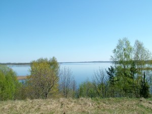 On the bank we can see a hothouse, but up a living house. Here it is convenient to land and go ashore. Ahead on the bank of the lake there is the castle mound Brāslava. There is no overgrowing on the castle mound so fabulous panoramas can be seen from the top of the castle mound to the lake Sivers and the Highlands of Latgale. The local inhabitants celebrate the Midsummer Day on the castle mound and here is a place for the Ligo bonfire.
Having enjoyed the nice sceneries we go along the river Dubna back to the lake Ārdavs. Arriving again in the lake Ārdavs along the right margin we go westwards to the overgrown lake Ploteņš. Here the opinion of cartographers and geographers differ – is Ploteņš a separate lake or just a creek of the lake Ārdavs? However it may be, in the latest cartography materials Ploteņš appear and we shall regard it as a separate lake, although when entering it we shall see that all around there are only reed and water-plants among that there is a few metres wide free water zone that in 800 m grows into the river Dubna. Having gone another ca. 450 m we arrive at Kombuļi-Auleja road bridge. Totally in the route we have covered 20 km.
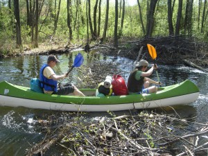 Behind the bridge we have to make another 750 m along the river Dubna and then we arrive at the lake Lejs. At the entry of Dubna in the lake there is a nice resting-place that is managed by the owners of 350 m distant guest house “Lejasmalas”. With the owners you can agree on shelter for the night. Here is place for tents or you can stay overnight indoors. On the rooms you should agree in advance.
Lejs or the lake Lejas is located in winding subglacial shallows between the lakes Ārdavs and Cārminis. The lakebed has a wide south part (arriving into the lake from the river Dubna it remains on the left from us) and a wedge-formed bottleneck on the north-west (in this direction we must continue the route). The lake has three depths – 30,7 m in the south part, 34 m opposite the eastern bank, it is the deepest point of the lake, and 15 m at the south-east end. The average depth is 8,2 m. Lejs is the tenth deepest lake in Latvia. Area of the lake is 177 ha, together with the islands 178 ha.
In the place where the widest south part of the lake gets into the narrower north-west part there are two islands that can be went round by the east or west side. We continue the route north-westwards – the lake becomes narrower and narrower till at the end of the reck we arrive at the source of the river Dubna and entry in the lake Cārmins. Here is also a bridge. In the route we have covered 22,4 km.
Cārmins (Cārmans) is the next lake in our route. Its area is 222 ha, together with the only island 224 ha. The length of the lake reaches 5,6 km, but the width 0,6 km. Average depth is 9,3 m, but maximum depth – 30,6 m. Cārmins is also one of the picturesque deep and large lakes in the hillock of Dagda. The lake is of subglacial origin, the shallows bent north-westwards and south-eastwards. The banks are sheer and overgrown so particularly beautiful landscapes can be seen in spring and nice autumn days. The lake has many creeks and recks. The deepest part of the lake is in the north part. Immediately after the only islands of the lake on the left side the river Dubna sluices. In some materials it is said that this is the real source of the river Dubna, but as it frequently happens, opinions about the sources of rivers differ. To protect the beautiful landscapes and frogbit family plants, in 2004 Cārmaņa lake country park “Cārmaņa ezera dabas parks” was established on the banks of the lake Cārmins with the area of 529 ha.
When entering the lake Cārmins we go initially along the left margin westwards. Gradually the route turns northwards. Ahead we can see two islands and behind them there is the mentioned source of the river Dubna. When moving northwards the lake becomes narrower and narrower and having gone for ca. 2,5 km from the mouth of the river Dubna into the lake Cārmins, we reach the narrowest place of the lake. Here the east bank is separated from the west bank by not more than 50 m. totally in the route we have managed ca. 25 km.
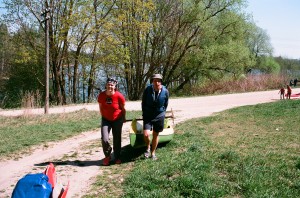 Having traversed the reck we go again into broader waters, but here we have to keep north-eastwards and we have to bypass the peninsula at the left bank. Behind the peninsula we have to move north-westwards. This is the widest point of the lake Cārmins. Ahead on the left bank after ca. 1 km we see a peninsula, having bypassed it we keep westwards to the church that can be seen on the bank. It is Raģeļi Catholic Church, next to it there is Raģeļu castle mound. In this point the lake Cārmins is closest to Grāveri-Jaunokra road and here is a good berthing place where it is easy to go ashore. Here we’ll have to carry the boats over the road to the lake Jazinks. We’ll have to carry for about 200 m. There will be some difficulties because the lake Jazinks at this pint is overgrown and a bit marshridden. Totally in the route we have covered ca. 28 km.
At the same time we can see Raģeļi Catholic Church. The first wooden church was built in 1780. After the First World War a turret was put on and a bell was hung up. In 1941 the wooden church burnt down, but a chapel was arranged in the proximal almshouse. The new stone church was consecrated on 30 September 1956.
There is a cemetery. Partially the cemetery is located on the former Raģeļi castle mound.
Ahead we have the last lake that we have to traverse in out route – the lake Jazinks. Its length is 4,2 km, but width 1,7 km. Area of the lake reaches 260 ha. Average depth is 8,1 m, but maximum depth reaches 33 m. Jazinks is the twelfth deepest lake in Latvia. On the south-west part of the lake there is the village Grāveri, sewage from there pollutes waters of the lake, that is why in the sixtieth the lake turned from mezotrophe into eutrophic and the overgrowing is 13%. Particularly it can be felt at the ends of the lake.
Having gone a short kilometre along the lake on the left we can see the village Grāveri. The village is located in a narrow, almost 2 km long area between Aglona – Krāslava motorway and margin of the lake. At the beginning, the first 1,7 km we cover along the narrower part of the lake. Behind the horn that stretches in the lake from the left bank, broader waters of the lake begin. From here we can already see the only island of the lake that is located in the middle of the lake at the widest part thereof. To the island we have to cover ca. 1,5 km.
Behind the island we continue the route just straight to the north-west end of the lake. However, we don’t go to the very end. Not far from the north-west end of lake on the left there is a creek with arranged resting place. Here it is possible to long conveniently. We have reached the finish of our route! Totally we have covered 32,3 km and traversed or been in 8 lakes (including Ploteņš).
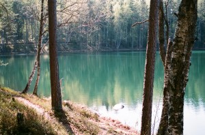 However, the tour won’t be perfect if we don’t see one of the most peculiar and mysterious lakes of Latvia – the lake Velnezers (Čertoks, Čortoks, Čertaks). The lake Velnezers is located ca. 250 m southwesterly-westwards from our finish. Not to be mistaken, we can go along a wood road that is by the margin of the lake Jazinks.
The lake Velnezers is a lake of suffosive origin. A crater depression is characteristic for it. Area of the lake is only 1,1 ha, but depth reaches 18,3 m! The water has small amount of salts so there aren’t many water-plants and water animals.
The lake Velnezers is one of the clearest lakes in Latvia that attracts with its peculiar blue-green water colour, big transparency and weird stories that from old times have twined the small lake. Water transparency in the lake is 12 m (according to other information – 8 m). The colour changes – the water can take all colours of the rainbow. This unusual feature can be explained with the fact that the water in the lake is very clear, it has no discharge and it has steep bank descents. If the banks were flat it would be more difficult to notice and appraise the beautiful colour of water.
In 1977 Čortoks lake nature restricted area was formed around the lake Velnezers with area of 55 ha. Several species of rare plants – sand pink, forest psque-flower, Dactylorhiza baltica and sweet butterfly orchid grow at the margins of the lake.
The lake and the restricted area are managed by AS „Latvijas valsts meži” that in cooperation with the University of Daugavpils have made a convenient sightseeing footpath.
At the end a reminder – you cannot swim in the lake in order not to facilitate its overgrowing and loss of the unusual colour!
The described span can be covered not hurrying in two days. More athletic water tourists can manage it in one day.
Lakes Jāša – Cirišs HPP reservoir
“Lakes Jāša – Bicāns – Kategrades – Zolvas – Seksti – Rušons – Katleņš – Skudrinka – Cirišs – Cirišs HPP reservoir – 35 km”
We begin the route in Kastīre village at the bridge-dike over the river Jāša (Jaša). Don’t mix with Preiļi-Krāslava motorway bridge over the river Jāša (Jaša)!
For ca. 850 m the route leads along the river Jāša (Jaša) upstream that is not very appreciable. In summer this span usually is overgrown with water-plants that cause some inconvenience. After 850 m extension of river source begins and after another 500 m we arrive in the lake Jāšezers (Jašezers).
Jāšezers (Jašezers) or the lake Jāšas (Jašas) is located in the Feimaņi hillock of the Highlands of Latgale, 149 m above sea level. Its area together with the island makes 97,8 ha. Length from north to south – 1,6km, maximum width – 0,8 km. The average depth reaches 2,8 m. Maximum depth is established in south end of the lake and it reaches 4,1 m.
Further we move north-eastwards to the reck that connects the lake Jāšezers with the lake Bicāns. On the right side there is a peninsula with oakery that now is protectable landscape feature. In 2004 Jāšas-Bicāns lake nature restricted area was established where the mentioned peninsula and islands of the lake Bicāns were included.
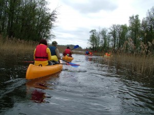 The total area of nature restricted area “The lake Jāšas and Bicāns” is 311 ha, ca. 82% of the total nature restricted area are occupied by both lakes. Ca. 15% of the nature restricted territory are covered by wood ca. 5% thereof are biologically valuable realms. Slightly-touched by people deciduous and broad-leaved trees wood biotopes with peculiar microclimate characterised by high humidity and other factors ensure the existence of rare, endangered and protectable lichen, moss and plant species. The usual tree lungwort found in the nature restricted area is a rare, air-humidity and light sensitive, high-value wood natural biotope indicator species both in Latvia and in Europe.
After short 2,8 km we have left the reck and arrive in the lake Bicāns.
The lake Bicāns is also located in the Feimaņi hillock of the Highlands of Latgale, 149 m above sea level. Its area is 159,0 ha, together with the islands – 164,2 ha. Length from north-east to south – 3,0 km, maximum width – 1,0 km. The average depth reaches 4,1 m. Maximum depth is established in south end of the lake about the middle between the first island that we see first when the entering the lake and the coast and reaches 18,8 m.
On the right bank of the lake Bicāns there is Geļenova park with tree species of rare occurrence. Structure of estate household buildings has also remained.
Geļenova part is natural site that is under national defence from 1957. It is a scenic park with 23 species of exotic trees and shrubs, the area is 8 ha that includes dry-land and waters.
The park was arranged in the peninsula of the lake Bicāns at the end of ninetieth of 19th century and at the beginning of 20th century, it belonged to estate manager who arranged the park in honour of his daughter Helēna. In former times the park was also so called –Helenova park. Estate building and adjacent buildings were in the territory of the park. The estate was imitation of the Renaissance style. In 1990 the remains of estate buildings were demolished, only the foundations have remained.
Local and induced species of tree plants have formed specific forest stand. In the south part of the park there is a plantation similar to wood park with big groups of larches and red oak-trees. Ca. 0,5km south-eastwards from the park there is an interesting larch stand. Such untypical for Latvia trees as Weymouth pine, European linden, Japanese larch, red oak-tree, white walnut, Caroline poplar, Tatarian maple and other interesting trees can be encountered in the park.
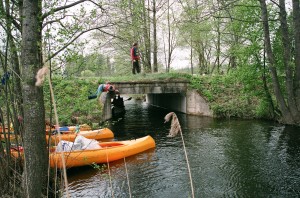 In the fifth kilometre we reach the constriction –the so called Turčinks (in other materials Percovka) that in Soviet maps is marked as a separate lake but now it is regarded as a creek of the lake Bicāns. Having traversed the creek after 300 m we arrive at the culvert of the motorway Jaunaglona-Kategrade-Kastīre that connects the lake Bicāns with the lake Kategrades (Zvejnieku). Here is also the guest house “Šaures” where you can agree on night’s shelter if necessary.
The area of the lake Kategrades reaches 134,4 ha. The length from north to south – 2,7 km, maximum width 0,7 km. The average depth of the lake is 1,6 m, in the deepest place it reaches 3 m. In summers the lake becomes very overgrown. Because the lake is not deep and is overgrown it is reach with fish. Under favourable conditions you can get here good catch of pikes.
At the north end of the lake Kategrades there is Kategrades castle mound. The castle mound is strongly overgrown with wood and has no explicit descents. The hill is 17 m higher than the ambient meadows. A story goes that this hill was brought by French soldiers during the war. This story, of course, has nothing common with the real origination of the hill.
Till Šaures we have managed 5,3 km. In the lake Kategrades we move southward, south-eastward. The south end of the lake in summers is usually strongly overgrown in the result of what floating islands are formed that in windy weather makes jams at definite places. Now the situation is so that the floating islands have filled the creek of the lake at railroad culvert. Therewith the boats must be either carried over the railroad or carried to the culvert and then pulled through the culvert to the lake Zolva. To the railroad we have managed 7,6 km.
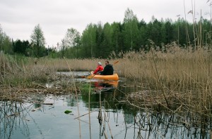 Also the west end of the lake Zolva at the railroad in summer usually overgrows, but the more we move eastward the rarer the overgrowth is.
The lake Zolva is also geographically located in the Feimaņi hillock of the Highlands of Latgale. If the aforementioned lakes were 149 m above sea level, then the lake Zolva is 149,6 m high above sea level. The area of the lake without islands is 351,2 ha, with islands – 359,2 ha. Length from north-east to south-east reaches 5,5 km, maximum width – 1,6 km. The average depth is 2,8 m, but the maximum depth exceeds 6,5 m. The deepest places are located at the west and north-west bank of the lake.
After 9,2 km we arrive in the wide waters of the lake Zolva. Here on the right banks you can see leisure complex “Zolvas”. Here is a guest house, sauna, campsite houses and sports grounds. In the further route we reach the peninsula that already during Soviet times was covered with buildings as the gardening society “Zolva”. Further we can se a light blue building that is a private rest-house. Stay here is possible only with permission of the owner.
On the north of the lake Zolva there is the Krupeniški castle mount, but in the north-east part Krupeniški old-believers village where only a few houses are populated. Here is a cemetery and old-believers’ preaching house that is in a bad condition! Larch stand that is not typical for Latgale is the most interesting landscape feature here. At this end of the lake if necessary it is possible to find an acceptable campground.
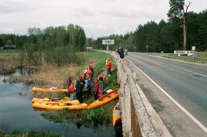 At the south-east end of the lake we reach the nullah Rušonīca. From the start we have managed ca. 12,6 km. Having gone short 1 km along the nullah Rušonīca we have reached Daugavpils-Rēzeke motorway bridge. Next to the parking-place ca. after 20 m in the wood there is an obelisk for members of Latvia freedom fights – 3rd Jelgava infantry regiment that during the Latgale liberation fights in 1920 fought here with the Bolshevists. The monument was unveiled on 16 August 1936; author of the design thereof was the engineer Zilēvičs. After the Second World War the upper part of obelisk was toppled. In summer 1988 it was placed back. The following ranks are cut in the monument: “3rd Jelgava infantry regiment battle scene in the liberty procession through Latgale. 1920.16.I. We brought the sun, liberty and independence to Latvia.”
Behind the bridge the route continues along the nullah Rušonīca. In spring this span doesn’t cause any difficulties but in summer the nullah usually strongly overgrows, floating islands begin to travel and beaver activities don’t stay without consequences also, and of course the nullah overgrows with water-plants. That is why you have to take into consideration that you’ll have to pull the boat for some span. When slushing through slime some leech chance to appear! The impassable span isn’t usually longer than 500 m.
 Sooner or later everything comes to an end! We have reached the small lake Seksts (area 16,0 ha without the island, with island 16,1 ha). 14,7 km are covered! When the nullah Rušonīcas discharges into the lake Seksti, ob the right side on the bank of the lake we can see steps. Here the boatmen can land and go onto the castle hill of Rušonīca (Rušenīca). Quite recently here were archaeological excavations, and VAS „Latvijas valsts meži” has put in order the castle mound and its surroundings – they have cut down the spare overgrowing, installed the steps and built a shed. It is worth to walk on the impressive bank that stretches northwards in parallel with the nullah Rušonīca. In the place where the bank ends steps are installed and you can get back to the castle mound by going along a wood road.
The first person who explored and measured the Rušonīca (Rušenīca) castle mound was Ernests Brastiņš on 29 and 30 July 1925. In 1928 the author published his description and measurements in the paper „Latvijas pilskalni: Latgale”.
Having traversed the small lake Seksti at the south-west end we arrive in the river connecting the lakes Seksti and Rušons. We have covered 16 km and arrived in the lake Rušons.
Area of the lake Rušons is 2373,0 ha, together with islands 2407,0 ha. It is the eighth biggest lake in Latvia. Maximum length reaches 13 km, but width – 5,5 km. The average depth is 2,9 m, but the maximum depth reaches 29,9 m and this place is located at the end of the creek Ūbeļu. The lake has complicated configuration and long coastline. The west part makes broader aquatorium, there are 10 conservation islands. In all there are 34 islands in the Rušons. Eastward the Rušons gets narrower and gets to the meandering creek Ūbeļu where there are many scenic creeks and islands. From the main part of Rušons it is separated by a big wooded peninsula so this long creek sometimes is called also the lake Ūbeļu. In this creek the tourists can spend several romantic hours.
When returning to our route – in front we see two islands, the smallest island has no name, but the biggest island is Ozolu island. Behind them you can notice Bērzu island that is famous for impressive colony of gannets (sea ravens). There are circa 30 occupied nests at the south end of the island. Here it is possible to establish a camp but it must be done at the north end of the island. However you have to take into consideration that there birds are not quiet and with dawn begin to rustle actively.
 From the Bērzu island you can see clearly Lielā (Upursala) island and the proximal Priežu island. It will be more convenient to establish the shelter for the night on the Lielā (Upursalas) island. On this island you must definitely see Rušona Upurakmens [sacrifice stone]. On the central part of Lielā (Upursala) island there is hill front on the highest part of what there is a stone that is still called the sacrifice stone. A story goes that once there have been writings carved on the stone and lambs were taken there for sacrifice. Nowadays no carvings can be seen on the stone. The Upurakmens is 1,2 m high, its circuit at the ground is 5,5 m. The stone is coarse-grained, its surface is crumbled. It seems that it had been artificially smoothened. Earlier a fire was burnt at the very stone and on it. Crumblings, splinters torn of it found around the Upurakmens testify thereof. Archaeological excavations were made at the Upurakmens. No antiquities were found in excavation by that the usage period of the island Lielā (Upursalas) could be determined. So far it can only be assumed that the sacrifice stone as a place for worshipping could have been used by the inhabitants of settlements Kristapiņi, Liepu salas and Mazie Mucenieki, and of Kurtošs castle mound, and also of other nearby ancient settlements.
When planning shelter for the night you have to take into consideration you speed of movement. You have to consider that when traversing the lake Zolva and entering the nullah Rušonīca it shall be troublesome to arrange a camp. So the camp places should be planned either on east end of the lake Zolva or on the islands or ashore when entering Rušons. If you have decided to arrange the camp on any of the islands of Rušons, then you should be careful towards the nature because these islands are nature protection objects. Don’t leave garbage here, but try to take it ashore! For real water tourists it goes without saying and it must not be reminded once more! It is differently with some local visitor of islands!
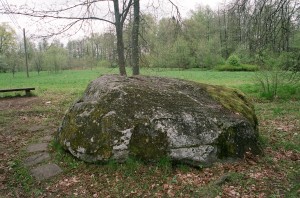 On the next day we move along the shore of the island Priežu and behind it we turn southwards to Jaunaglona. The white church of Rušona is left behind on the west coast. When moving to Jaunaglona the tower is a good reference-point that can be well seen. We enter Jaunaglona creek and by channel we go to the dike. We have managed 22 km. Here we’ll have to carry the boats. They can be carried to the next street and only then released in water because the culvert under this street is narrow and during high water level difficult to pass. In summer it is passable. Over the dike where we have stopped goes a street. When going along the street westwards after 100 m we arrive at Kameņeca Great stone.
The former name of Jaunaglona was Kameņeca that is derived from Polish. It is directly connected with Kameņeca Great stone whose length is 3,2 m, width 2,7 m, height 1,5 m. On one side plane of the stone in a rectangle form framing a text is carved in Polish that nowadays is hardly to be read. In Latvian it sounds like this:
“With permission of the holiness (meant Pope) Clemens XIII in 1766. And on this Peter rock a chapel was built by the example of Roman Catholic faith of our land and that stone gave the name Kameņeca („Kamieniec”)”.
This inscription indicates that on the stone or near it there has been a catholic chapel – preaching house. Stories written down in the beginning of our century testify that really there has been a church on the stone where several tens of people could go in. Perhaps the chapel wasn’t built exactly on the stone and it was inside the chapel. In other stories it is said that the lightning has split the stone in two parts and the chapel crashed. However, the Kameņeca Great stone has also the characteristics of cult stone – a regular cylindrical cavity is carved in the highest place of it (diameter 30 cm, depth 30 cm). It is supposed that originally the stone really had been a component of pagan sanctuary. By introducing the Christianity that became active in Latgale in the 17th century due to Jesuit activities a chapel was established in the place of the old sanctuary.
After 500 m we reach Jaunaglona-Rēzekne/Daugavpils motorway bridge behind that we go into a small lake with the name Katleņš (Katliņš). When we have covered 23,2 km, we enter the lake Skudrinka (area 9,4 ha). North part of the lake is continued by Tartaks where we continue the route to Aglona – Preiļi motorway bridge. This span is easy passable both in summer and spring and doesn’t cause any difficulties.
When arriving at the abovementioned bridge we have covered 24,8 km from the beginning of the route. Here is also the entry of Tartaks into the lake Cirišs.
 The lake Cirišs is the second biggest lake in our route. Its area without the island is 629,3 ha, but with the islands 663.34 ha. Upursala (18,24 ha) and Joksti (Ošu) island – 15,80 ha, two biggest islands of the district Preiļi are located in the lake Cirišs. Length of the lake from north-west to south-east is 5 km, but width 2,5 km, the average depth 5 m, but the maximum depth 10,5 m. The lake Cirišs and the lake Ruskuļi and surroundings in area of 1297 ha are included in the country park “Cirīšu ezers”. Islands of the lake Cirišs are included in the restricted area of the park and the provisions of nature protection state that in the restricted area it is forbidden to arrange tourist halts where the tourists stay for more than three days and nights. So water tourists can surely stay one night on any of the islands.
Along the Jaunmuiža creek we bypass the peninsula Jaunmuiža (Ksaverina) at the end of that there is a campsite and we go to the island Upursala. In Upursala VAS “Latvijas valsts meži” has arranged a footpath that is worth walking and getting acquainted. Going along the footpath we can arrive at the hill Upurkalns of the island Upursala. Previously it was regarded that the hill Upurkalns of the island Upursala is a cult place not modified by people. In 1977 the archaeologist J.Urtāns surveyed Upursala and archaeological excavations were made in Upurkalns and at its foot under his supervision. It was found out that Upurkalns has features characteristic to a castle mound. Although the hill and island have significant name, archaeological excavations didn’t reveal nothing that could be surly connected with the traditions of ancient cult. According to the found antiquities the usage of the hill Upurkalns of the island Upursala is to be dated with I millenary B.C- the beginning of I millenary A.C., but the settlement at the foot of the hill had formed around the middle of I millenary.
From Aglona to the island Upursala you can get by a motorized floater by notifying it in advance. With the boats you can stop at the east of the island or at the side of Aglona, at the same place where the floater lands. The boats can be conveniently left by the established plank-way. Here you can arrange also a good halt, but you have to take into consideration that for a big group it will be a bit for small! To the island Upursala we have managed 28,4 km.
With visiting the island Upursala we could end the two-days long route and go over the reck to the bathing ground of Aglona where it is easy to land and drive up with transport.
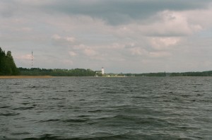 If you want to fully enjoy the beautiful landscape that greets from the lake Cirišs to the basilica of Aglona, then it is advisable to continue the route along the lake and end the tour at the south-east end of the lake not far from the parking-place of basilica of Aglona. In this case the total managed length of route shall be ca. 30 km.
If it is planned to continue the route, then bypassing the island Upursala we go further in the direction of the island Joksti (Ošu). Behind the island Joksti (Ošu) in a creek on the left there is fitted place for tents that is located on private owner’s land and staying overnight must be agreed with the owner. Tartaks or the nullah Salinieki sluices in the creek on the right by that you can get in Ciriša HPP reservoir. Source of Tartaks from the lake Cirišs is 30,5 km from the beginning of the route. Covering ca. 2 km along the Tartaks we have reached the Aglona-Višķi motorway bridge and after another 0,7 km we reach the entry of the nullah in Ciriši HPP reservoir creek.
Ciriši HPP reservoir is one of the biggest dammed lakes of artificial origin in Latgale. This dammed lake is the sixth biggest among lakes of natural origin in the former district Preiļi. Ciriša HPP reservoir was created in 1960 by building a hydroelectric power station on Tartaks and by raising water level for 10-12 m. Depending of work of dikes the area of reservoir can vary from 210-260 ha. Before formation of the reservoir here were a chain of small lakes that were mutually connected by the river Cirišs. These lakes had settled in the subglacial furrow so the maximum depths were big and reached even 34,5 m. In the chain of these lakes there were lakes Dziļūksna, Jagodki, Pirtspakurs, Tūļeišs, Raudiņi and the mill lake Sekļi. Length of the reservoir is 7,3 km, width reaches 2,6 km.
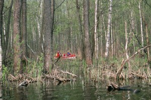 We continue the way along the creek till we arrive in the big reservoir. Here we turn eastwards and go to the second island where is our next shelter for the night. We have managed 34,7 km.
Depending on speed of movement the described span can be managed in two days. The fastest water tourists have got also to the lake Pakalns (Pakaļņu) and have arranged the halt on the banks of this lake. With further description of the route you can get acquainted in description “Along Tartaks” and continue the route.
Around the lakes Sivers and Drīdzs
Short description of the route:
Sauleskalns t/b – Soleimi – Dzalbi – Brāslava castle mound – 10 km
Brāslava castle mound – Vanagi – Rubeņi – Kiški – Bleideļi – Sivergala – 10 km
Sivergala – Kubuļniški – Lozdi – Crossroads with non-surfacing road – 9 km
Crossroads with non-surfacing road – Stoli – Glagači – Luņi – Trapiciški – Skaista – 14 km
Skaista – Grundāni – Orupi – Čenčupi – Pārpuci – 10 km
Pārpuci – Plociņi – Dricmuiža – Pīzāni – M. Unguri – Sauleskalns – 10 km
Totally 63 km
Throughout route asphalt covering makes 2km, covering of gravel – 24km, improved earthen road-28km, dirt road-6km and difficult passed dirt road – 3km. A relief mainly equal, with separate lifting and descents. The big lifting is before Skaista, but before it will be pleasant descent. Also there are dirt roads and hard passed dirt roads on route, but they should not deliver special difficulties to bicyclists without dependence from weather conditions. It will be more unpleasant if on these roads during bad weather conditions recently passed agricultural machinery. In separate places at Sivers difficulties can arise because of strong wind when it blows from outside lakes. As Dridzs is narrow and is situated in a deep hollow, than wind will be felt less here. Any physically active person can overcome this route. To children, at the age from 10 till 12 this road can seem too long and tiresome. Certainly, it depends on character of the child and its physical preparation. Shop visiting needs to be planned in Skaista, as there are no shops in other places. There is small booth in Sauleskalns, but assortment of goods is very limited. Tubes and other necessary details of first necessity are required to take with you. Possibilities for comfortable spending the night are limited. It is possible on tourist base of Sauleskalns, in a camping of Kaziņči, on the bank of lake Sivers and in a rest complex „Dridži” near Skaista. But it is always possible to find places for tents, only at first you need to arrange with land owners.
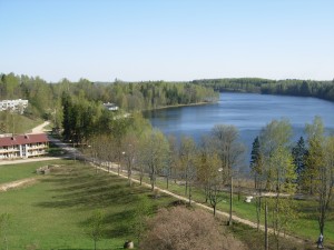 Most convenient it is to begin the trip at the Sauleskalns tourist base. Here you can easy leave the car and if necessary also stay overnight. However, before you should contact the owners of the base.
We begin the trip with driving up the hill – past the apartment houses along the bank of Drīdzs creek. When going out of the wood and reaching the clearing on the right we see the lake Ota.
After 2 km we arrive at a crossroads where we turn left. On the right side we see the Soleimi creek of the lake Ārdavs, after another 1 km beautiful landscapes greet on the 210 m high Sauleskalns and on the lake Dubiņš at its foot, and also on the creeks of the lake Ārdavs. Further follows a small descent and after another 1 km we have reached the road Kombuļi-Auleja. Ahead we have the small lake Joda, but having gone a bit on Auleja side on the same side we see already the Guļbiņš.
After 3 km we reach the turn to Vanagi. Shortly before that we have crossed the river Dubna, before that on the right side we could see the next in turn creek of Ārdavs – this time it is Ārdavs leg.
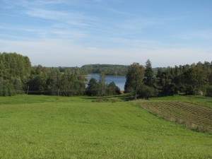 Having gone ca. 1,5 km along the Vanagi road immediately after Krūgeri cemetery on the right side we see an impressive hillock – it is Brāslava castle mound. At the foot of the castle mound there are houses and a good path leads to them. You definitely must climb on the Brāslava castle mound – fabulous views greet there from on the lake Sivers and its surroundings. Local inhabitants celebrate Midsummer Day on the castle mound and here is lit the Ligo bonfire. The river Dubna flows out of lake Sivers at the foot of the castle mound and it is very convenient to start the water tourism route here.
Having enjoyed the nice sceneries we continue the way and after 2 km we arrive at Vanagi crossroads. Here we turn right and continue the way as close to the bank of the lake Sivers as possible. The road has obtained recently new gravel syrfacing and together with the nice sceneries it gives emotional pleasure. On the way we can observe the mode of life and construction traditions of Latgallians – in this span in the stretch of 6 km we go through several small villages with names Plotie, Rubeņi, Drongāni, Māteļi, Kiški till in Bleideļi we arrive at crossroads with Auleja – Konstantinova road. Here we turn right and go to Sivergala. Totally in the route we have covered approximately 20 km.
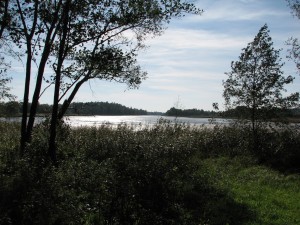 In Sivergals it is possible to go to the Bleideļi creek. It is the longest and narrowest creek in the lake Sivers – the length thereof reaches 2 km. Having seen the creek we go further and at the former farm complex we turn right. The road goes on the South and after 3 km comes quite close to the bank of the lake. Here it is possible to completely enjoy the beauty of the lake Sivers! Landowners have arranged here a nice resting-place. Having asked for permission, perhaps the travellers are also allowed to rest here and enjoy the nice sceneries.
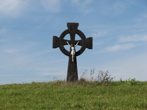
Having gone ca. 1,5 km on the left side of the road a peculiar crucifix is place that associates with the crosses of ancient Celts or Vikings. On the right there is the northern-east utmost creek. Further we have to continue the way to Lozdi and ca. after 1,7 km behind the abandoned houses we must turn right and continue the way along the “back” of the hillock through pasture on a non-surfacing road. Separate roads shall branch off on the left, but we have to keep right and after ca. 1,2 km we shall reach a good gravel road and after another 2 km we arrive at a motorway on crossroads. Totally in the route we have covered ca. 29 km. In the crossroads we turn right and go 4 km to Stoli cemetery. On the way we can enjoy the scenery of the lake Sivers. Before Kazinči there is a turn on the campsite. Behind the Stoli cemetery on a farm track we turn right and we continue the way keeping as close as possible to the bank of the lake Sivers. In this span on the road you can see grass-snakes, particularly active they are on sunny days when they like to lie on the warn sands. We continue the way to Luņi. Here our way is obstructed by a high fence. Behind the fence there are possessions of the former owner of Parex bank that occupy areas around the lakes Ārdavs, Ots, Sīvers and Drīdzis. Common people are not allowed to be in these possessions and it means nothing that cordage zone law is valid – laws are not equal for everyone!
 At the gates of the fence we turn left and we continue the way along the fence in South direction. After 1 km we reach crossroads where we turn left. Now the deepest lake in Baltics – Drīdzs (65,1 m, according to latest information 63,1 m) is in front of us. Here begins our tour around the lake Drīdzs. It must be marked that the bed of the lake Drīdzs is narrow and formed in deep valleys between the hillocks. Although our route goes close to the bank of the lake here it will be more difficult and seldom to see impressive natural landscapes with Drīdzs in the centre as it was on the bank of Sivers.
After 4 km we have reached Skaista – Konstantinova motor road. The remaining 3 km to Skaista are very scenic. Here we can see splendid scenes on the hillocks of Latgale and eastern creek of the lake Drīdzs that is as narrow as a river at this place.
Nice in our route is the biggest populated area and centre of Skaista parish of Krāslava county. Circa 900 (937 inhabitants in 2000) inhabitants live here. If it is necessary you can shop in the local stores. In Skaista we see the Roman Catholic Church. The first wooden church was built in Skaista in 1788 (according to other information in 1778). In 1914 the church was moved to Geibi village where during the First World War it burnt down. In 1920-1921 the dean Šinkelis built the present corner-jointed church and established a parish. Totally in the route we have covered 43 km.
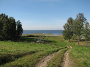 Having seen Skaista we go a bit back along the Skaista – Konstantinova road and turn left – here also is a mark to the recreation centre „Dridži”. If you don’t plan to manage the route in one day then it will be very comfortable to stay overnight at „Dridži” and continue the route on the next day.
When turning on the mentioned road we can enjoy one more time the Drīdzs and impressive scenes of locality. Further follows a descent and we continue the way along a farm track to the 3,5 km distant Grundāni. Here on the left behind the houses we can se very well the Grundāni castle mound that well stands out on the joint scene. The first person who investigated and described the castle mound was Ernests Brastiņš in the twenties of the last century. In the picture of that time it can still be seen that the castle mound is without overgrow and it was ploughed except for northern-east side of the castle mound because it is sheer, but now it is covered with a thick wood. According to general appearance this is a solitary castle mound in a low place. The height thereof from the foot to surface is ca. 20 m. There have been terraces on the sheerest sides of the hill in place of what now there are left just flat cavities. When excavating an occupation layer was found.
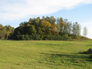 Particularly black and deep this occupation layer is on the south side of the hill. Different chips of dishes and other usual remains of castle mound life were found there. It is said that rings, axes, necklaces and money were also found here. All things that were found before the First World War were sent to Petersburg. Perhaps this hill was used as a cemetery during the recent Iron Age. A legend tells that in former times a castle stood on the Grundāni castle mound. It sank in the hill. One cannot dig in the hill. Once the boys dug and saw that someone had stuck out from the hill life black fingers.
We continue straight to Orupi and we arrive at a T – form crossroads. From Skaista we have covered ca. 6 km. On the crossroads we turn right and continue the way along Čenčupi cemetery. The road becomes more and more deserted till it turns into two trails crossing the pasture. However this span isn’t long – ca. 0,5 km and having crossed a ditch we arrive at a sign of private property and a good ground road. On the left from us the lake Mazais Ožukns remains in the wood. We go straight and after another 0,5 km we reach a gravel road where we have to turn right. Soon on the right side we can see the lake Drīdzs. This is the utmost southern creek of the lake Drīdzs. Someone has unsuccessfully begun here a construction, but now all is abandoned!
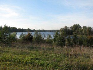 We continue the way and after 1 km we reach Pārpuči. Here we turn right and along the Veceliški cemetery we go to Plociņi. Here is a sharp curve. In this curve behind the houses we turn right and along a non-surfacing road that is driven over the pasture we continue the way in straight direction. The span of non-surfacing road lasts ca. 0,7 km then it becomes again well passable and after another 0,7 km we have reached crossroads where we have to turn right. To the crossroads we have covered in total 57 km.
We continue the way to Pīzāni. In Pīzāni on crossroads we can see nice scenery back to the creek of the lake Drīdzs and the hills and valleys of Latgale.
In Pīzāni we have to turn left and go 2,5 km till we reach Kombuļi – Auleja motorway where we turn right and go to the mark on Sauleskalns, by turning where we arrive at out starting place – Sauleskalns recreation centre. Totally in the route we have covered 63 km.
The lake Lubāns
Short description of the route:
Lubāns wetland Tourism information centre – Īdeņa – 10 km
Īdeņa – Teirumnīki marsh footpath – 5 km
Teirumnīki marsh footpath – Nagļi – 6 km
Nagļi – Zvejsola – Dimanti – Kalnagals sluice – 19 km
Kalnagals sluice – Lubāns wetland Tourism information centre – 17 km
Totally – 57 km
During route asphalt covering is 3 km of road, gravel covering – 32km, the improved dirt road-19km and a dirt road – 3km. A relief is equal. Complexities can arise because of a strong wind when it blows from outside Lubāns lakes or towards surmountable route. During rain or some time after a strong and long downpour it is difficult to go, there can be improved roads. Any person who does not have other physical activity can overcome a route. Also children at the age from 10 years can overcome it. Problems can arise during or after rain, when separate roads of route are soaked, and also during wind. It is difficult to predict, what time will occupy this route. It depends on speed of movement, duration and frequency of rest and quality of roads. It is necessary to consider that buy products and essential commodities it is possible only in Nagli. It is impossible to get bicycle details here and it will be necessary to take it with you.
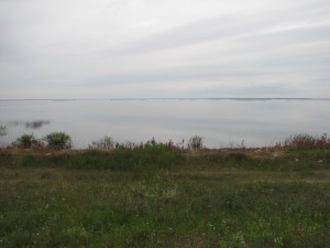 You can spend the night in rest house „Zvejnieki” and in the rural house „Paeglīši” in Ideni. In the middle of Kvapanu pond is situated rest house „Birzes”. If you want to spend the night on the nature then it is possible to offer a camping „Dimanti”. It is possible to put tent near Information Tourist Centre Lubāns. Then it is possible to settle down in a new camping near Kvāpānu ponds.
Lubāns – the biggest lake in Latvia. Its area is 80,7 km2, with the islands 82,1 km2. Length of the lake Lubāns reaches 14 km, width – to 9 km, but the average depth is just 1,6 m. To tell the truth, nowadays only small part of the former lake Lubāns can be “seen” because due to natural conditions and such caused by people multiple decrease of water level has happened. In olden times area of the lake had reached maximum 700 km2. Former the lake Lubāns flooded large areas in springs. In the book “Mazās piezīmes” [small remarks] author Kārlis Skalbe describes the impressive floods of the lake Lubāns in the twentieth of last century. To comprehend the volume of the floods it is advisable before the tour to read the description in the mentioned book. On this account restructuring work of the bank and surroundings was done in the thirtieth and fiftieth-seventieth of the 20th century by creating a dike system, sluice, polders and other hydrotechnical buildings. Rare hydrologic phenomenon was connected with the lake Lubāns and the river Aiviekste sluicing from the north part of the lake till the lake was diked in: in strong floods the water of the river Aiviekste and rivers discharging into it– Iča, Balupe and partially Pededze – flew not downstream, but back to the lake Lubāns because the slope of the rivers in the plain of Lubāns was small.
The lake Lubāns with the adjacent marshes, meadows – former flat valleys and ponds that are an important birds resting and nesting ground, is a wetland of European importance. In 2009 Lubāns wetland nature restricted area was founded. It contains the former nature restricted areas – Īdiņi marsh, Īdeņa and Kvāpāni ponds, Lubāns and Sūļagala marsh, Pārbaine, Sala marsh, Teirumnīki (Tīrumnieki) marsh, Salenieki marsh, lowland of Lubāna, etc. The restricted area is the territory of Natura 2000 and it is created to ensure joint protection of Latvian largest inland wetlands complex. The restricted area with acreage of 51 632 ha is a unique European and world nature complex with outstanding importance for preservation of many particularly protected species populations and preservation of biotopes. The lake Lubāns and fish ponds are one of the most important resting and feeding grounds of crossing migrating water birds in the country, and also one of five best nesting grounds for 48 European endangered bird species. 4 bird species – white-tailed eagle, greater spotted eagle, snipe and corncrake are included in the list of world’s endangered bird species. Totally 225 bird species are observed in the territory, 187 of them nest here. Five observation towers and one platform are built around the lake Lubāns to observe the birds but the below mentioned tourism information centre was created to obtain information (tel.29234956).
It is advisable to begin the cycle tour around the lake Lubāns from the Lubāns wetland Tourism information centre that was built in 2007. This centre is built at the lake Lubāns and source of the river Aiviekste. Here the visitors can receive information on the nature values in the territory of wetland and offer of neighbourhood tourism. Here is a parking-place where you can conveniently leave the car and also possibilities to stay overnight.
We begin the route in direction of Gaigalava. Here the road curls along the very margin of the lake and here are the best places to approach the lake. Here are fitted bathing-grounds with firm and sandy bank and bed. In the further way access to the lake and finding a good bathing-ground is difficult.
After short 1,5 km we reach Gūmeļš bird observation tower that is the first one in our tour. When getting on the tower on the right you can see the lake Lubāns, but on the left the lake Gūmelis that actually is a creek of Lubāns and in the result of dam construction was completely separated from the lake. Water level in the lake Gūmelis is lower than in the lake and ranges depending on the level of flood and precipitation. In a way here you can see the landscape what the lake Lubāns was before the limitation by dams.
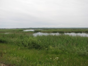 Having managed 4,5 km from the start point we arrive at a campsite that was built by the means of EU within the framework of Latvia-Lithuania cross-border project. The campsite is located on the left side of the road at the ponds of Kvāpāni.
Ponds Kvāpāni is an artificial reservoir system created for fish farm needs consisting of five ponds. Total area is 6,26 km2. The ponds are delimited with dams. Dam on that is the Lubāna-Gaigalava motorway separates the ponds from the river Rēzekne and the lake Lubāns. Pond system was created within the period from 1965 to1980.
After something over 0,5 km we arrive at the mouth of the river Rēzekne into the lake Lubāns. Length of the river Rēzekne reaches 116 km. From Rikava parish Murāni the river is controlled. Ponds formed on the riversides are filled with waters from the river Malta, but water from the ponds is discharged into the river Rēzekne. Bellow the ponds Orenīši water from the river Malta is delivered in the river through a channel whereby the outlet and reservoir of the river Rēzekne is doubled. From Žogotas to the lake Lubāns the river is dammed in the length of 13 km.
After 2,5 km we arrive at a turn to Īdeņa and a bridge over the river Rēzekne. From the start point we have managed 8 km. Further we go in the direction of Īdeņa and after short 2 km we arrive in Īdeņa. Īdeņa is like a peninsula that rises above the former flood-lands of Lubāns between the east par of the lake Lubāns and the ponds of Īdeņa. Ponds of Īdeņa are formed on the peatmarsh of Lubāns flood-lands at the same time as the Kvāpāni ponds and are included in the Kvāpāni – Īdeņa pond group. In the cemetery of Īdeņa you can see Īdeņa mortuary. This wooden building was erected in 1896 and is an architectural monument. The mortuary serves for the local inhabitants also as a preaching house. Further we go to the Īdeņa castle mound. Before that in Zvejnieki house you can visit the tourism information office, or start the tour from here. Here it will be possible to leave safely the cars and stay overnight.
Behind Zvejnieki houses south-westwards there is an archaeological monument of Late Iron Age – Īdeņa castle mound from where you can see a nice landscape on the lake Lubāns. In 1925 the first person who described and investigated Īdeņa castle mound was Ernests Brastiņš. He found that the castle mound has been ploughed for ages. Different wires, tins and rings have been found when ploughing. A farmer had kept a found silver spoon with round handle and decorated with flowers. But in the course of time it had got lost. Banks, ascents and terraces were ploughed with the lapse of time because the soil here is rather rough, crumbling sand.
A white cross is erected not far from the castle mound that can be well seen from the road and closest surrounding. This cross is erected in remembrance of the fallen national partisans and inhabitants of Īdene that were repressed in 1949.
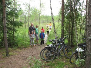 Further we go in the direction of Nagļi. After 4 km we arrive at a wood road that on the right goes into the wood. Here is erected also a sign to the Teirumnīki marsh nature footpath. After another 1 km we have arrived at the start point of the footpath. Totally we have covered 15 km.
The footpath in the length of ca. 800 m is made in Teirumnīki marsh. It is possible to leave the bicycles at the beginning of the footpath an along plank-way go to see the scenes of marsh and the flora: bog-moss, cranberries, sundews, cotton-grass, marsh Andromeda, etc. The footpath goes along the south margin of the lake Teirumnīki where three observation platforms are built. From the platforms you can see beautiful sights on the dark water of lake where the surrounding scene reflects like in a mirror. The further span of the footpath goes through a typical open marsh landscape with small marsh dwarf pines. After the traversed marsh we can go along a wood road to the start point of the footpath.
The route can be continued by returning on Īdeņa-Nagļi motorway or by continuing to go along the wood road in direction of Nagļi. Since many wood roads cross here, the main thing is to follow the direction and to choose the well driven roads. It is difficult to get lost because the wood area from west is enclosed by the abovementioned way, but from the east Malta-Rēzekne channel.
If we choose to return on the motorway then there are ca. 5 km to Nagļi when going from the beginning of the footpath. On the crossroads we turn left and go to Nagļi Catholic Church. If you have planned to shop then you have to take into consideration that the shops are in the part of the village that is behind Malta bridge, it means you’ll have to go more forward behind the Nagļi Catholic Church.
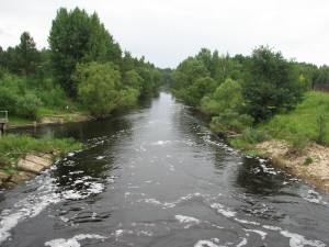 The present stone Nagļi St John the Baptist Catholic Parish Church is build in 1862. It was built by then estate manager Nābels that was a Lutheran. Already in the 18th century there had been a slam wood church in Nagļi that was services by Viļāni Bernardine. Art monument – St. Lucas sculpture made in the 18th century is located in the church.
Having seen the church we move forward to the bridge over the river Malta, or to be more precise over Malta-Rēzekne channel. To 1966 the river Malta discharged into the lake Lubāns, but when creating the hydrotechnical system of the lake Lubāns, the river Malta was discharged by the channel Malta-Rēzekne to the river Rēzekne. We are at the top end of the river by the sluice that form Nagļi reservoir in the valley of Malta. The river Vecmalta forms Īdeņa channel span in the length of 6 km. On the left we can see Nagļi HPP that was commissioned in 2001. From the beginning of the route we have managed 21 km.
Further we go back to crossroads where we turn right in the direction of Īdeņa and in the first road we turn left. Our route goes in the direction of the lake Lubāns. On the both sides of the road you can see ponds. On the right there are Nagļi ponds, but on the left-Ļodāni ponds.
After ca. 3 km we arrive at the turn to Zvejsola house. We continue the route straight and Zvejsola ponds appear on the right. Quality of road surfacing becomes worse and the tourists have to consider that in wet weather you can have to meander among the puddles and slide on clay. In dry weather the road causes no problems. Having covered another 3 km we have reached the lake Lubāns. Further the road gradually turns left and curls along the south margin of the lake Lubāns. At the beginning the bank is mainly overgrown with shrubs, but in separate places you can see nice sights on the width of the lake Lubāns. Īdeņa channel being a part of Lubāns hydrotechnical system winds on the left in parallel to the road. The span of route from Zvejsola house to Dimantiem practically is deserted. The road, separate anglers and fishermen settlements and their huts are the only things that are indicative of presence of people. The deserted span of the route is 10 km long.
In Dimanti there is another bird observation tower, here are also tent places and a campsite in the beginning stage. The bird observation tower is built at the very south-west end of the lake Lubāns and here you can observe the scenes of the lake in all its length. Administratively Dimanti is located in Madona county Barkava parish. From Dimanti the road quality becomes better again. From the start point of the route we have covered 36 km.
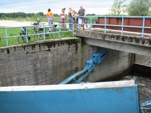 Having managed short kilometre from Dimanti the road turns left and we begin to move away from the lake Lubāns. On the right from road a new channel- excretory duct of the lake Lubāns appears. After another 2,7 km we arrive at Kalnagala-Lubāna excretory duct sluices-place where you can see channel and sluice scene not characteristic to Latvia, one of the knots of the huge Lubāns hydrotechnical system. Meirāni channel makes a sharp turn here that the waters of Teicija, Malmuta, Lisiņa and other smaller rivers that earlier flew into the lake Lubāns discharges into the river Aiviekste. Here in Meirāni channel are discharged also waters from Lubāns excretory duct, the river Īdeņa and Zvidziena channel, ad here is also the crossroads of the roads built by the dams. The sluice mechanism thoroughly suffered during spring tide in 2010. Meirāni channel is the first hydrotechnical building that was dug already from 1853-1896 to discharge from the south-west end of the lake Lubāns part of the waters of the lake to the river Aiviekste.
From the beginning of the route we have managed 40 km. Further our route goes right along dam road. For ca. 2 km the road is good, but gradually it turns worn-down, but there is no difficulty with going by bikes. On the left from the road we can see Zviedziena channel, but on the right there is a wood. Such landscape can be seen for ca. 9 km, when the road again approaches the lake Lubāns. After ca. another 1,5 km we have arrived at bird observation tower. Here you can observe the landscapes of west coast of the lake Lubāns. Opposite the tower in the lake we can see the only island of the lake Lubāns – the island Akmeņsala. Since there is quite convenient access this place is esteemed by anglers.
Further we continue the route along the margin of the lake Lubāns. Now the Zvidziena channel is on the right from the road –between the road and the lake. Having gone 5 km we arrive at Degumnieki-Gaigalava motorway. Here we turn right and along the motorway we go to the star point of our route. Having covered 2,5 km we arrive at the start-finish point. The circle is completed. Total length of the route is 57 km.
Around the lake Rušons
Short description of the route:
Guest house „Silmalas”- Rušonīca castle mound – Bridge over the nullah Rušonīca – 6km
Bridge – lake Seksti – Ūbeļu inlet – Dudari – road Rušonīca-Svātova – 14 km
Road Rušonīca – Svātova-Svātova – 7 km
Svātova – Dunski – Muša – Blaževiču castle mound – Geraņimova – 10 km
Geraņimova – Bērzgale – Jaunaglona – 9 km
Jaunaglona – Rušona – guest house „Silmalas”- 8 km
Totally – 54 km
Throughout route the asphalt covering is 6 km of the road, the improved dirt road-19km and a dirt road – 11km. A relief is equal. In wood during dry weather difficulties can create dirt roads as their cloth it is similar to beach sand. Having dried up it can get stuck in a bicycle wheel, having complicated movement. Rain can create problems only on absolutely short sites of road. Moving on Davgavpils-Rezekne highway, it is necessary to be careful of heavy traffic, especially, if you have planned a trip with children. Any healthy person can overcome the route for one day, and children senior than 10 years. Purchases need to be planned in Jaunaglone, but here it is possible to purchase only products and essential commodities. If you need to repair bicycle then necessary details can be got only in Aglone.
At good weather and desire to have a swim the best swimming places are on both coasts of peninsula of Ubeli gulf and near the guest house „Silmalas”.
You can spend night in the guest house „Silmalas” in Siverenie, in rest house „Jāņi” in Sekstos, in the rural house „Pagalmiņi” in Lielas Bernanos, in rural house „Trepes” and in hotel of Jaunaglona high school in Jaunaglone. All these places, except for hotel of Jaunaglona high school, give possibility to spend the night in tents.
 Rušons is the eighth biggest lake in Latvia and with its many creeks and island is one of the most picturesque lakes in Latvia. Its area is 2373.0 ha, together with the islands 2407.0 ha. Maximum length reaches 13 km, but the width – 5.5 km. The average depth is 2.9 m, but the maximum depth reaches 29.9 m and this place is at the end of the creek Ūbeļu līcis. The lake has complicated configuration and long coastline. The west part makes broader aquatorium, there are 10 conservation islands. In all there are 34 islands in the Rušons. Eastward the Rušons gets narrower and gets to the meandering creek Ūbeļu līcis where there are many scenic creeks and islands. From the main part of Rušons it is separated by a big wooded peninsula so this long creek sometimes is called also the lake Ūbeļu ezers.
As it is testified by the archaeological objects, finds and written historical sources, the surroundings of the lake Rušons has been populated very long ago and heavily. Some of these objects in the cycle route we shall get to know also in presence.
It is convenient to begin the route from the guest house „Silmalas” that is located in the Siveriņa, north-west part of Rušons, ca. 1 km from motorway Daugavpils-Rēzekne. By agreement with the owners you can leave the car here and if necessary also stay overnight.
We begin the tour north-eastwards on the mud road along the lake creek. The road goes through a wood. We pass two houses. At the second house we turn right and go till we see the third house. Here is a T-form cross. We have gone 1,5 km and at this cross we turn left and continue the route on a wood road to the motorway Daugavpils-Rēzekne. We choose the better beaten roads – it ensures getting on the mention motorway. When gone another 1,5 km we are on the motorway. We continue the route on the right and after 0,5 km we turn again right in the wood and continue the route on a wood road. In about another 0,5 km we arrive at wooden steps leading uphill. Here we leave our bicycles and go to see the Rušonīca (Rušenīca) castle mound.
 From the steps we get in an expressive bank and along the crest of the bank we go southwards in the direction of castle mound. The bank is narrow with sheer slopes. Sheerer they are on the side of river Rušonīca that now and then can be noticed through the trees. After ca. 0,5 km we arrive at Rušonīca (Rušenīca) castle mound. Several banks and moats that we have to cross testify thereof. Dimensions of castle mount plateau reach the length of 90 m and width of 60 m. Triple entrenchment and banks are around it, except for north-east side. These intrechements together with castle mound plateau occupy ca. 200 m long and 100 m wide plot. Most of all our ancestors have lent a hand on the north-west side of the castle mound where the castle mound has merged with the already mentioned bank. Perhaps the attackers had to overcome here 3 moats and banks. All three moats and banks after that bend round the south of the castle mound plateau here and there flattening, and then again forming 4 m sheer hillsides. Banks and moats end at the east side on the sheer coat of the river Rušonīca. At this place the coast of river reaches the height of 16 m. South side of the castle mound very flatly immerses in a marshy wood. Two entries go through the fortification lines, one from north-west and the other from south side. These entrances are well preserved and for experts are easy to notice. Quite recently here were archaeological excavations, the pits left from excavations testify thereof. VAS „Latvijas valsts meži” have put in order the castle mound and its surroundings – they have cut down the spare overgrowing, installed the steps to the lake Seksti and built a shed at the foot of the castle mound. The first person who explored and measured the Rušonīca (Rušenīca) castle mound was Ernests Brastiņš on 29 and 30 July 1925. In 1928 the author published his description and measurements in the paper „Latvijas pilskalni: Latgale”.
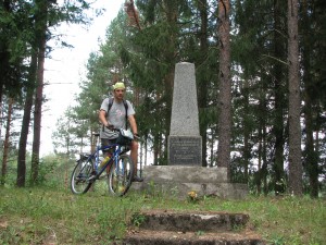 Having got acquainted the castle mound, from the shed at the foot of the castle mound we go along the wood road back to our bicycles and return on the motorway Daugavpils-Rēzekne. Here we turn left and go in the direction of Rēzekne. After 0,5 km we cross the river Rušonīca behind that there is a parking-place. Next to the parking-place, ca. after 20 metres in the wood there is an obelisk for members of Latvia freedom fights – 3rd Jelgava infantry regiment that during the Latgale liberation fights in 1920 fought here with the Bolshevists. The monument was unveiled on 16 August 1936; author of the design thereof was the engineer Zilēvičs. After the Second World War the upper part of obelisk was toppled. In summer 1988 it was placed back. The following ranks are cut in the monument: “3rd Jelgava infantry regiment battle scene in the liberty procession through Latgale. 1920.16.I. We brought the sun, liberty and independence to Latvia.”
In olden times the obelisk was built on the aide of motorway, but after the new bridge and road was built you can go by the obelisk by not even noticing it. Sadly, but no one has taken care also about the reference marks. We have gone circa 6 km from the beginning of the route.
After seeing the obelisk we go 300 m forwards the motorway and on the first cross we turn right and continue the route on a good gravel road.
After 1,4 km we get in a crossroads where there is a reference to holiday house “Jāņi”. This road leads to dead end but it is worth going because after 1,2 km you can enjoy landscapes that greet on the lake Seksti and Seksti creek of the lake Rušons. Over the lake Seksti on the north side in a wood you can notice the outline of Rušonīca (Rušenīca) castle mound. We return to the gravel road and continue the route till the next crossroads. On the crossroads we turn right. This road goes to peninsula that is enclosed by Ūbeļu creek of the lake Rušons from the one side and by the waters of the Rušons itself from the other side.
This is one of the most beautiful spans of the route. Peninsula is covered by beautiful pinewood although in separate places it is quite deforested. In reck of peninsula the road leads closely along the lake Rušons and Ūbeļu creek. A small resting-place is established on the coast of lake Rušons. Here you can conveniently swim because the lake bed is covered with white sand and it becomes deeper very gradually. When arriving at Ūbeļu creek nice sights greet on the many creeks enclosed by woods. In soviet times this peninsula was very esteemed by inhabitants of former Leningrad who arrived here in their cars and lived here in tents for weeks. Historically this peninsula is populated by old-believers. Of course, as in whole Latgale here also the number of inhabitants has decreased and there are many abandoned houses. When turning on the road that leads along the south coast of Ūbeļu creek, on the head of the hill we arrive at Duduri cemetery. Here you can see the cemetery culture and traditions of the old-believers.
Further through the wood we make a bow on the interior of the peninsula and return on the known road from that we return at the crossroads and we continue the route on the right. Totally in the route we have covered 20 km (19,6 km).
The road is good with restored gravel surfacing so routing doesn’t present any difficulties. After 1,4 km the road crosses a ditch or a small river. The river disgorges into the lake Gadrinka that can be seen on the right side through the shrubs. To reach better the lake we have to go a little bit further and turn right, go onto a small hill and then again on the right till we get to the place where you can get to the lake.
As the lake Gadrinka is located in the middle of the wood its water is very clean; the white waterlilies testify thereof that blow here in bulk. The average depth of the lake is only 1 m, but the maximum depth 1,7 m. The lake Gadrinka is connected with Diunokli that actually is a creek of Ūbeļu creek that is separated from the Ūbeļa creek with a 200 m long reck.
Having enjoyed the lake Gadrinka we return on the motorway and continue the route. This is a deserted and lonely span so frequently there are cases when forest animals cross the road.
After 1,6 km on the right we can see buildings and a pond overgrown with reed pa, these are Kirkiliškas. We have entered the Pušas parish. After another 0,4 km we cross the nullah Pušicas.
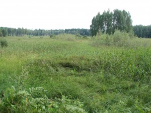 The road continues through a wood and after 1,1 km we arrive at Mušas ponds. The water in ponds is passed and they are overgrown with reed and in places it begins to overgrow also with shrubs. After another 0,9 km we arrive at Malta-Priežmale road. Totally from the beginning of the route we have covered 26 km (25,83 km).
We cross the abovementioned road and go to see the lake Svātova. The lake Svātova is the second biggest lake in the Pušas parish. Its area reaches 133 ha, maximum depth – 6,1 m. We have to go 500 m from the motorway to the lake. The banks of the lake are gently sloping and low, the bed is smooth and muddy. Having seen the lake we return on the motorway and continue the route in Priežmale or south direction. The road is still enclosed by wood, but after 2 km the wood ends and we get in a glade. Not only we have left the Puša parish, but also the Rēzekne county and we have entered Aglona county Kastuļina parish. After another 0,7 km there is a road on the right that we have to take. We have covered 30 km.
We continue the route and after 0,7 km a beautiful scene greets on the lake Mušas. Having gone round the south end of the lake Mušas we arrive at a bridge. The nullah we cross connects lake Geraņimovas Ilzas with the lake Rušons. When going away the road on the left after some metres we can get at the north end of the lake Geraņimovas Ilzas that in summers is badly overgrown with waterweeds. Behind the nullah the road turns sharply on the left and goes parallel to the lake Geraņimovas Ilzas. From the lake it is difficult to see something because the lake is in a deep bed. The lake Geraņimovas Ilzas is the fifth deepest lake in Latvia. The maximum depth reaches 43 metres.
From the bridge we have gone circa 2,2 km, on the right there is a farm track that we take and go to Blaževiči castle mound. We have to go circa 0,8 km till the castle mound. Here is how Ernests Brastiņš describes the castle mound in his book „Latvijas pilskalni: Latgale” published in 1928. The text is kept in the original style: „1 km on the south of Blaževiči parish where the peninsula furthest juts in a quadrangle against the west, there is a 12 m high small hill that is called „Gorodoku” and it belongs to the mentioned Blaževiči parish (Kapiņi parish, Daugavpils county).
This castle mound has even plateau, in a longish round form it is 65 m long, 40 m wide. The sides are the highest and steepest on the west side that is directed to the lake Rušons. Eastern sides from nature have been flat and therefore they erst were protected with terraces or ribs. Now this earthwork is already ploughed because on the plateau there is a cornfield. Solely the ends of terraces have remained on the north-east side of the hill.
The entrance isn’t definable anymore, but it could have been only on the flat east side.
The north end of the plateau that is left fallow has got covered with scrubs. The sheer west side is free from trees and its steepness looks impressively. The south side of the plateau ploughed up and thus black occupation layer with beaten stones and different chippings is dredged up. Chippings are thick and thin, turned and pasted, decorated and undecorated. It is obvious that this castle mound had been populated for a longer period.
An old man had told that when clawing in „Gorodokā” the children have found also different metal chains and rings. However in the plough land we couldn’t find nothing suchlike.”
It was written by Ernests Brastiņš. Everyone will be able to verify how the surroundings of the Blaževiči castle mound looks now by turning in here and seeing.
After seeing the castle mound we return on the road and go in the direction of Geraņimova that is reached after 0,8 km.
Till First World War Geraņimova estate was an outstanding castle of Empire style that during the Soviet times was rebuilt into a psycho-neurological hospital. Nowadays it is managed by the social care centre „Krastiņi”. Geraņimova Estate Park with linden path has also remained.
On the crossroads where three roads branch we have to go straight – on the less used. Having gone ca. 1 km on this road we arrive at the reck separating the lake Rušons from the lake Biržkalns (Kapiņi, Bērzgale). Totally in the route we have covered 38 km (37,7 км).
We cross a bridge over the reck and along a farm track past the houses we go further till we reach the motorway. Till the motorway Jaunaglona-Kapiņi we have to go ca. 1 km. In rainy weather this span could be sloppy but easy passable on a bike.
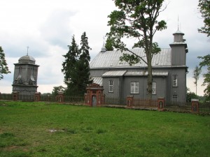 On the motorway we turn right and continue the way till Bērzgale Catholic Church that can be seen well from the road.
Bērzgale Catholic Church is one of the most beautiful wooden churches in Latvia and one of the most interesting wooden architectural monuments in Latgale. It is the oldest in whole Aglona county. Construction of the church was proposed and supervised by Stefans Mickevičs, the parish dean of that time. The foundation of the church was laid in 1744, construction was finished in 1750 and consecrated in 1751 by the Livonian bishop Jozefs Domings de Kozeļskis-Puzika as God’s solicitude and St. Stephan and St. Laurence custody church. Money for construction of the church was given by Sokolovski, the landlords of Rēzekne county, and by Heronims Oskerko, Vilnius prelate, who owned the Eisbahova estate. The church was built by the peasants. It is built from lumber that are planked. 32 art monuments can be exhibited in the church. Altar and organ prospectus of 18th century have preserved. In the yard you can see the standing apart bell-tower that was built in the 19th century.
After seeing the church we continue the route in direction of Jaunaglona. After 4,7 km we arrive at Jaunaglona.
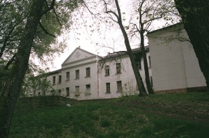 Till 1927 Jaunaglona was called Kameņeca. Here is the ensemble of former Kameņeca estate – dwelling house, chapel, and stables with surrounding stone wall. All this is the architectural monument of 18th century. Estate castle was built in 1875 in neo-Gothic style. It was inhabited by Felherzami, then Pavloviči and Reuti families.
Originally the castle was built as a three-story building, later in Reuts period it was rebuilt. 7 m high tower was built on the side of the building, workers were observed from there. The estate is enclosed by 7,5 ha wide park with plantation of foreign trees and shrubs. In 1929 a nunnery and gymnasium was established here, in 1940 mechanization school. After recovery of independence Aglona catholic parish retrieved it in its possession that also manages the castle.
Kameņeca HPP is located in the westward direction from the estate castle. Originally in 1833 a mill was built on the Tartaka nullih, but in 1930 Aloizs Broks begun the construction of a power plant because it was necessary to light the buildings of nunnery and gymnasium. In 1947 in the result of heavy rainstorm the water level rose strongly and the dam was destroyed because all facilities were wooden and worn-out. The renewed HPP was unveiled on 5 November 1948 that was built in 34 days. HPP gave power to neighbourhood of Aglona and Jaunaglona to 1960. In 1960 HPP was dismantled because Ciriša HPP was built.
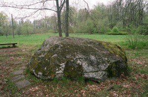 In the estate park behind the Kameņeca HPP sluice on the side of the street there is the Kameņeca Great stone, whose length is 3,2 m, width 2,7 m, height 1,5 m. On one side plane of the stone in a rectangle form framing a text is carved in Polish that nowadays is hardly to be read. In Latvian it sounds like this:
“With permission of the holiness (meant Pope) Clemens XIII in 1766. And on this Peter rock a chapel was built by the example of Roman Catholic faith of our land and that stone gave the name Kameņeca („Kamieniec”)”.
This inscription indicates that on the stone or near it there have been a catholic chapel – preaching house. In the beginning of our century the written stories testify that really there was a church on the stone where several tens of people could go in. Perhaps the chapel wasn’t built exactly on the stone and it was inside the chapel. In other stories it is said that the lightning has split the stone in two parts and the chapel crashed. However, the Kameņeca Great stone has also the characteristics of cult stone –a regular cylindrical cavity is carved in the highest place of it (diameter 30 cm, depth 30 cm). It is supposed that originally the stone really had been a component of pagan sanctuary. By introducing the Christianity that became active in Latgale in the 17th century due to Jesuit activities a chapel was established in the place of the old sanctuary.
Behind the Jaunaglonas HPP on the peninsula on the margin of the lake Rušons there is the so called gallows corner. In the spring 1905 peasants from 16 villages of Jasmuižas and Kapiņi parish participated in devastation of estates and cutting of landlords’ woods in Aglona surroundings. Worried by the landlords reports and frightened Vitebsk governor with seven companies of soldiers arrived in Daugvapils county to suppress rebellion. Any turn against the landlords was severely suppressed. Till 1930 a big pine-tree, the so called “Gallows pine” grew on the Gallows corner on that the disobedient peasant of Kameņeca and also of other estates, and also rebels from Poland were hung. Later the pine-tree was sawn and the local people regarded it as a monument that reminded of arbitrariness of landlords. Not far from the place of former Gallows pine in 1978 a memorial stone was placed with an inscription „Punishment place of revolutionists of 1905”.
You will have to go ca. 2.5 km through the village to get to know Jaunaglona and its historical places. Having finished the sightseeing we return on the motorway and on the right we go in the direction of Rušona. Soon the white tower of Rušona church is to be seen ahead in the distance, on the right you can enjoy the landscapes of the lake Rušons. We pass the Kristapiņi cemetery and after a while we arrive at Rušona church. From Jaunaglona we have made 4 km.
As it is testified by the archaeological monuments and finds and the written historical sources, Rušona (Vecrušona) was the centre of Rušona county. It is the place where we are right now. In 1456 Rušona estate was mentioned that has belonged to Johannes Rebinder. Rušona county included also Aglona with the neighbourhood. Name of Aglona appear in historical sources only in the 18th century.
The first Rušona wooden church, one of the oldest in Latvia was built in the 16th century. In 1677 Jesuits with the support of the landlords Sokolovski-Korabi build a new wooden church in place of the old one. In 1766 the Rušona landlady built a new wooden church and a cloister instead of it, but in 1816 the present Rušona stone church with cloister complex was built with the resources of Ieva Selicka. 4 art monuments are situated in the church but in the cellars thereof the monks were buried.
Rušona county in old times has been not only a remarkable Latgallian administrative and economic, but also intellectual centre. Here are many places that are called sanctuaries, cult or sacrificial places. From here in Rušons you can see the Great (Upursala) island with its sacrificial stone. The closest to the margin is the island Liepu sala where there is the archaeological monument – settlement. Nearby there is Kurtoša castle mound. All this testifies of the ancient growth of this place. In the historical literature it is written that Rušona through that the international trade route went as a populated place grew so big that it even had hamlet rights.
On the right side between the road and Rušons we can see considerable improvement and restoration works. The private owner renovates the Rušona (Vecrušona) estate building and the surroundings.
218 m long linden path connects Rušona Catholic Church with the Rušona estate that has suffered during storms. Rušona estate castle was built in 1903. It is one-storied stone building with two-story central part. Rušona estate castle was built in neo-Renaissance architecture style and it is enclosed by a beautiful park that over the years has become quite squalid. Hopefully the new owners shall put in order also the park.
So to the Rušona church in the route we have covered 51 km. At the church we turn right and straight continue the route.
After ca. 1,3 km on the left side we can see houses. Behind these houses you can notice the lake Lielais Kurtošs. Here is also the Kurtoša castle mound. Since early days the castle mound is being treated so partially it has lost its heritage value. Also visually it is difficult to distinguish it from the joint scene.
This is the last sightseeing object in our route and after another 1,2 km we have returned in the starting point of our route that this time is also the finish line. Totally we have covered ca. 54 km.
Contactform
Error: Contact form not found.
Contact Us
Phone number:
(+371) 26 44 25 35
E-mail:
[email protected]
Adress:
Liepu street 9 – 19
Preiļi, LV – 5301
Featured about us
SIA „Dēkaiņi” has commenced the work in the field of active tourism. The volume of our services includes services for water tourists and bicycle tourists. We offer inventory rent and preparation of route according to client’s wishes. We work actively on development of cycle routes and water tourism routes. The mission of the company is to popularize the options offered by Latgale in the field of active tourism, to rouse interest in the potential clients to visit Latgale and to enjoy the options offered by this county. In this sphere of activity we see many options that are still unused.
About Us
SIA „Dēkaiņi” engages local inhabitants of Latgale, active water and cycle tourism enthusiasts who know very well the tourism infrastructure of the given region, nature and cultural history sightseeing objects, who have developed new and within limits summarized the existing water and cycle tourism routes. The work on development of new tourism routes, inspection thereof in nature still continues.
[spoiler]The aim of our company is by use of plenty of nature (rivers, lakes, hills, castle mounds, etc.) and cultural history (churches, estates, etc.) objects in the region and services rendered by tourism infrastructure (guest houses, campsites, hothouses, museums, catering, etc.), to offer optimally developed tourism routes for leisure activities lovers. Local tourism infrastructure services would be used within their frameworks, they would be planned so that the natural resources were used as carefully and accurately as possible and the insight as big as possible would be given into the choice of nature and cultural history objects.
The routes are developed so that they can be combined. Water tourism routes are developed for two to three days, but some routes can be continued for some more days. Cycle routes are mostly developed for one day, but they overlap so the potential client could choose how many days long trip he wants to go on. We offer the clients during one trip to go not only on water tourism or cycle tourism routes, but to combine them. It means to cover a define span of the route on boats, but further to continue it by cycles. Our company shall deliver the inventory necessary for the respective span of the route.
There are possibilities to stay overnight both in the open air-in tents, and under the roof-in campsites, guest houses and recreation centres.
For convenience the client can arrive at us by the car. The cars shall be parked in a safe parking-place depending on the chosen route. Further the tourists shall be taken with our transport to the beginning of the route and after the finish taken back.
To rouse interest to visit Latgale we offer a brief insight into its history, culture and nature.
Latvia has five culture-historical counties – Kurzeme, Zemgale, Vidzeme, Sēlija and Latgale.
Latgale is the most peculiar and different culture-historical county in Latvia. History of Latgale remarkably differs from the history of the other territory of Latvia. Joint history of Latgale with the rest of Latvia begun to form just from May 1917, when the congress of representatives of Latgale took place in Rēzekne where it was decided on reunification with other culture-historical counties of Latvia. Many Latvians from other counties still perceive Latgale as something exotic. Reason for that is not only the wonderful and beautiful nature of Latgale, but also the culture of Latgale that is formed by mutual influence of many nationalities and ethnic groups that live here for centuries. Latgallians, Russians, Byelorussians, Lithuanians, Hebrews and Poles living in Latgale have developed here their culture, language, architecture, art, craft, cultivated their traditions and mutual household culture. Latgale cultural heritage is represented by such architecture monuments as cathedrals, churches, public buildings, town ensembles, and also country estates, characteristic populated areas and cultural landscapes. Latgale culture traditions-language, folksongs, dances, craft form an important part of Latvian national culture.
First information on contemporary territory of Latgale are found since the times of Jersika king state in the turn of 12th and 13th centuries that in the Latin texts is called as “Latvia” (Lettia), but in ancient Russian texts as “Latgale” (Лотыгола). Unlike the rest of Latvia where the dominant confession is Lutheranism, in Latgale dominates the Roman Catholic Church. Latgale is separated from Sēlija by the river Daugava and from Vidzeme – the rivers Aiviekste and Pededze. On the East Latgale borders on Russia, on South-East on Byelorussia and on the South on Lithuania. The total are of Latgale makes 14.55 km2 that is 22,52% of whole territory of Latvia.
Indisputably nature is one of the greatest values of Latgale. Latgale is the richest in lakes region in Baltic States. In this territory there are more than 2000 lakes. In the south part of Latgale there is the Highlands of Latgale with the highest point – Lielais Liepukalns whose height is 289 m above sea level. The lowland of Austrumaltvija with the plain of Lubāns stretches into the northern part of Latgale in the middle of what there is the largest lake of Latvia – Lubāns. Around 2009 Lubāns wetland nature protected area was founded. It is a nature complex of European and world importance with an outstanding significance for preservation of many especially protected species population and biotopes. The protected area is the territory of Natura 2000 and it is created to ensure joint protection of Latvian largest inland wetland complex. Its area is 51 632 ha.
The valley of the biggest river of Latvia- Daugava – has remained untouched in Latgale. Country park “Daugavas loki” is located in the span from Naujene to Krāslava in the area of Augšdaugava protected landscapes, on both banks of the river Daugava. It was founded in 1990 and is a remarkable sightseeing object where you can see the unique Daugava old valley nature complexes and peculiar cultural heritage. Here Daugava has still kept its primitiveness, here is geologically and landscape the most manifold span of the valley with 10 huge river meanders – Daugava bows; complicated wherewith interesting conformation; natural and not destroyed scenery; rich flora. When travelling over Augšdaugava you can fully enjoy the exuberant scenery of Daugava.
One of the biggest Catholicism centres in Baltic – Aglona basilica is famous not only in Latgale and Latvia, but also in Baltic States where thousands of pilgrims gather every year, and in some way it is to be regarded as the intellectual and religious centre of Latvia. In September 1993 the Pope John Paul II visited Aglona. Unlike the rest of Latvia in Latgale many churches are well preserved and maintained due to strong religious traditions, just like many art objects, mainly icons and crucifixes. The list of Latgale cultural heritage contains more than 6000 different objects: castles, estate ensembles, churches, farmsteads, territories of towns. Almost half of them are monuments of national importance. Many old estate and park complexes have preserved in Latgale that were established as far back as in the 18th and 19th centuries. Estate ensembles with servant houses, hors stables and granaries are still to be seen. Parks, gardens and ponds with island are preserved in many places. The most part of the archaeological objects (castle mounds, cult places and ancient burial places) are located in the central part of the Highlands of Latgale and along Daugava.
Welcome to Latgale![/spoiler]


