Lakes Drīdzs – Jazinks
Lakes Drīdzs – Jazinks
“Drīdzs-Ots-Ārdavs-Sivers-Ploteņš-Lejs-Cārmins-Jazinks-32 km”
Most convenient it is to begin the route at the recreation centre “Dridži” that is located at the east end of the lake Drīdzs, ca. 2 km from Skaista. But Skaista is located 16 km from Krāslava when going along the motorway Krāslava – Dagda – Rēzekne.
 In the recreation centre for definite pay it is possible to leave the car and if necessary to stay overnight. The centre is guarded so the cars will be in safe keeping.
Drīdzs is the deepest lake not only in Latvia, but also in the Baltic States. The average depth is 12,8 m, but according to latest measurements the deepest point reaches 63,1 m. (Mainly the depth of 65,1 m appears in different materials). Physiogeographically the lake Drīdzs and other lakes in the route are located in the hillock Dagda of the Highlands Latgale. It has formed in subglacial bed so the lakebed sometimes looks like large, winding and wide river.
Areal of the lake Drīdzs is 753 ha (with islands 772 ha), length 9,8 km, the widest part is located o the West and reaches 2,4 km. There are nine islands in the lake – the biggest one is the island Bernata (Bernāta) with area of 13,9 ha, the other islands are quite small.
In 1938 the Latvian hydrobiologist Bruno Bērziņš (1909-1985) stated in the middle of the lake Drīdzs the biggest depth of Latvian lakes. In 1939, when making measurements from ice, 1681 depth measurements were made and a detailed depth map was prepared. Water exchange takes places only once in 12,5 years, water brings a bit of nutrients. When compared with information from 1939, the amount of oxygen has decreased significantly in the deepest water sheets, in some creeks at the depth of 8 m it is not at all. It creates flowering caused by cyanobacteria that is disliked by the living beings of the lake.
In 1977 the complex nature restricted area was formed around the lake Drīdzs with the area of 2520 ha. In 1999 the nature restricted area was changed into country park of the lake Drīdzs. Its task is to preserve and protect the landscape of lakes and hillocks characteristic to the south part of the Highlands Latgale.
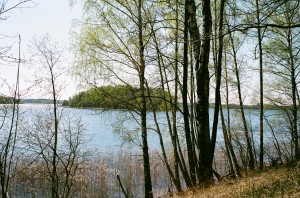 At the beginning of the route there is really a feeling that we tour along a big river. Having covered ca. 3 km we reach the creek Šaure that is on the right from us. We have to continue the route a bit on left. When going in this direction we shall se the island Bernata (Bernāta). There is the hill Baterija on the right bank of the lake at the end of peninsula opposite the island Bernata (Bernāta). In fact, the hill Baterija is a castle mound. To the hill Baterija we have managed 5,6 km. Here it is convenient to land with boats and go ashore.
Further we move along the reck between the bank and the island Bernata (Bernāta). Behind the reck the lake Drīdzs grows wider. This is the widest part of the lake in our route that north-westward becomes ever narrower. We approach the hill Sauleskalns. The narrow creek before the hill Sauleskalns is called the foot of the lake Drīdzs.
After 9,1 km we have reached the recreation centre of Sauleskalns. The origin of the recreation centre is to be searched already in Soviet times. The hill Sauleskalns itself is a cult place of the ancient Latgallians. The head of hill rises 210 m above sea level (according to other information 211m above sea level), relative height exceeds 50 m. In clear weather here you can see great panorama from the Highland of Latgale on the mirrors of the many lakes and creeks. It is said that 27 lakes can be seen in clear weather. If separately seen creeks of one lake are also counted then there are even more!
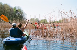 After seeing the hill Sauleskalns we board in the boats and go back. We try to keep closer to the left bank because after ca. 2,2 km there shall be a flow connecting the lakes Drīdzs and Ots. When reaching the flow we have managed totally 11,3 km. In fact, this is not just a flow but a channel. The channel was dug in the twentieth of the 20th century and it decreased the level of the lake Drīdzs for 0,5m. When the water level is higher the water from the lake Drīdzs flow to the lake Ots, and there are no problems to go through the channel by boats. More difficult it could be in summers when the water level is lower. Length of channel is ca. 250 m and at the end of the lake Ots it is quite strongly overgrown with reed. Having traversed the channel we arrive in the lake Ots.
Area of the lake Ots (Ats) is 120 ha, together with the four islands – 124 ha. Average depth of the lake is 2,4 m, but maximum depth reaches 7,4 m. Length west-eastward is 1,9 km, but maximum width reaches 1,1 km. the lake has seasonal water supply through the channel from the lake Drīdzs, and also from the amelioration ditches. Eutrophic lake. By pining-up of mud, since the fiftieth the depth of the lake has decreased for ca. 1 m. That is why here is more fish than in the proximal lake Drīdzs.
Having entered the lake Ots we keep to the left. Having bypassed the peninsula we shall see ahead a ca. 100 m wide reck that is formed by two peninsulas both from west and east side. We have to go to this reck. Having reached the reck we have covered 12,3 km in the route.
Having gone through the reck we keep at the left bank and ca. after 700 m we shall arrive in a river that connects the lakes Ots and Ārdavs. Unlike the channel that connects the lakes Ots and Drīdzis the nullah is of natural origin. This nullah also doesn’t cause any difficulties with traversing and after ca. 300 m we reach the lake Ārdavs. We have managed 13,3 km.
The lake Ārdavs (don’t mix with the lake Ārdava in the parish Pelēči of the county Preiļi) is one of the most spectacular lakes in our route. The coastline is very twisty with many creeks and peninsulas. Length of coastline is 18,8 km. It forms a semicircle around the hill Sauleskalns. Area of the lake is 229 ha, with islands 230 ha, length in the semicircle by the axial line is 4 km, but width in the east part reaches 1,2 km. Average depth is 4,6 m, but maximum depth reaches 14,0 m. The deepest points of the lake are in the west (14,0 m) and south-west (12,0 m).
Having entered the lake Ārdavs on the right we see the biggest island of the lake that is located between the peninsula on the east and the bank of the west. After ca. 500 m we have reached the reck separating the peninsula from the island. Peninsula is like a narrow tongue stretching in the lake. Here it is convenient to land and a good place to arrange a halt. When going around the island and along creeks some water tourists have got quite good catches of pikes. To the peninsula we have covered 13,8 km.
Further our route goes straight northwards to the entry of the river Dubna in the lake Ārdavs. If we are so close it would be a sin not to see the ninth biggest lake in Latvia – Sivers, and no to go on the scenic impressive 15 m high castle mound Brāslava. To do this we have to find the entry of the river Dubna. Our direction is straight to the end of the lake ahead. After ca. 1,6 km we have reached a narrow peninsula on the east bank. Having bypassed the peninsula we have actually arrived in the delta of the river Dubna. When going ahead the delta grows narrower and turns into a river. Although we have to go upstream it cases no difficulties and after 900 m we reach the lake Sivers. Totally in the route we have covered 16,3 km.
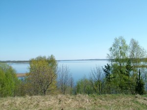 On the bank we can see a hothouse, but up a living house. Here it is convenient to land and go ashore. Ahead on the bank of the lake there is the castle mound Brāslava. There is no overgrowing on the castle mound so fabulous panoramas can be seen from the top of the castle mound to the lake Sivers and the Highlands of Latgale. The local inhabitants celebrate the Midsummer Day on the castle mound and here is a place for the Ligo bonfire.
Having enjoyed the nice sceneries we go along the river Dubna back to the lake Ārdavs. Arriving again in the lake Ārdavs along the right margin we go westwards to the overgrown lake Ploteņš. Here the opinion of cartographers and geographers differ – is Ploteņš a separate lake or just a creek of the lake Ārdavs? However it may be, in the latest cartography materials Ploteņš appear and we shall regard it as a separate lake, although when entering it we shall see that all around there are only reed and water-plants among that there is a few metres wide free water zone that in 800 m grows into the river Dubna. Having gone another ca. 450 m we arrive at Kombuļi-Auleja road bridge. Totally in the route we have covered 20 km.
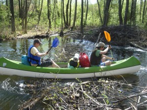 Behind the bridge we have to make another 750 m along the river Dubna and then we arrive at the lake Lejs. At the entry of Dubna in the lake there is a nice resting-place that is managed by the owners of 350 m distant guest house “Lejasmalas”. With the owners you can agree on shelter for the night. Here is place for tents or you can stay overnight indoors. On the rooms you should agree in advance.
Lejs or the lake Lejas is located in winding subglacial shallows between the lakes Ārdavs and Cārminis. The lakebed has a wide south part (arriving into the lake from the river Dubna it remains on the left from us) and a wedge-formed bottleneck on the north-west (in this direction we must continue the route). The lake has three depths – 30,7 m in the south part, 34 m opposite the eastern bank, it is the deepest point of the lake, and 15 m at the south-east end. The average depth is 8,2 m. Lejs is the tenth deepest lake in Latvia. Area of the lake is 177 ha, together with the islands 178 ha.
In the place where the widest south part of the lake gets into the narrower north-west part there are two islands that can be went round by the east or west side. We continue the route north-westwards – the lake becomes narrower and narrower till at the end of the reck we arrive at the source of the river Dubna and entry in the lake Cārmins. Here is also a bridge. In the route we have covered 22,4 km.
Cārmins (Cārmans) is the next lake in our route. Its area is 222 ha, together with the only island 224 ha. The length of the lake reaches 5,6 km, but the width 0,6 km. Average depth is 9,3 m, but maximum depth – 30,6 m. Cārmins is also one of the picturesque deep and large lakes in the hillock of Dagda. The lake is of subglacial origin, the shallows bent north-westwards and south-eastwards. The banks are sheer and overgrown so particularly beautiful landscapes can be seen in spring and nice autumn days. The lake has many creeks and recks. The deepest part of the lake is in the north part. Immediately after the only islands of the lake on the left side the river Dubna sluices. In some materials it is said that this is the real source of the river Dubna, but as it frequently happens, opinions about the sources of rivers differ. To protect the beautiful landscapes and frogbit family plants, in 2004 Cārmaņa lake country park “Cārmaņa ezera dabas parks” was established on the banks of the lake Cārmins with the area of 529 ha.
When entering the lake Cārmins we go initially along the left margin westwards. Gradually the route turns northwards. Ahead we can see two islands and behind them there is the mentioned source of the river Dubna. When moving northwards the lake becomes narrower and narrower and having gone for ca. 2,5 km from the mouth of the river Dubna into the lake Cārmins, we reach the narrowest place of the lake. Here the east bank is separated from the west bank by not more than 50 m. totally in the route we have managed ca. 25 km.
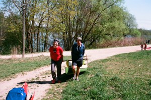 Having traversed the reck we go again into broader waters, but here we have to keep north-eastwards and we have to bypass the peninsula at the left bank. Behind the peninsula we have to move north-westwards. This is the widest point of the lake Cārmins. Ahead on the left bank after ca. 1 km we see a peninsula, having bypassed it we keep westwards to the church that can be seen on the bank. It is Raģeļi Catholic Church, next to it there is Raģeļu castle mound. In this point the lake Cārmins is closest to Grāveri-Jaunokra road and here is a good berthing place where it is easy to go ashore. Here we’ll have to carry the boats over the road to the lake Jazinks. We’ll have to carry for about 200 m. There will be some difficulties because the lake Jazinks at this pint is overgrown and a bit marshridden. Totally in the route we have covered ca. 28 km.
At the same time we can see Raģeļi Catholic Church. The first wooden church was built in 1780. After the First World War a turret was put on and a bell was hung up. In 1941 the wooden church burnt down, but a chapel was arranged in the proximal almshouse. The new stone church was consecrated on 30 September 1956.
There is a cemetery. Partially the cemetery is located on the former Raģeļi castle mound.
Ahead we have the last lake that we have to traverse in out route – the lake Jazinks. Its length is 4,2 km, but width 1,7 km. Area of the lake reaches 260 ha. Average depth is 8,1 m, but maximum depth reaches 33 m. Jazinks is the twelfth deepest lake in Latvia. On the south-west part of the lake there is the village Grāveri, sewage from there pollutes waters of the lake, that is why in the sixtieth the lake turned from mezotrophe into eutrophic and the overgrowing is 13%. Particularly it can be felt at the ends of the lake.
Having gone a short kilometre along the lake on the left we can see the village Grāveri. The village is located in a narrow, almost 2 km long area between Aglona – Krāslava motorway and margin of the lake. At the beginning, the first 1,7 km we cover along the narrower part of the lake. Behind the horn that stretches in the lake from the left bank, broader waters of the lake begin. From here we can already see the only island of the lake that is located in the middle of the lake at the widest part thereof. To the island we have to cover ca. 1,5 km.
Behind the island we continue the route just straight to the north-west end of the lake. However, we don’t go to the very end. Not far from the north-west end of lake on the left there is a creek with arranged resting place. Here it is possible to long conveniently. We have reached the finish of our route! Totally we have covered 32,3 km and traversed or been in 8 lakes (including Ploteņš).
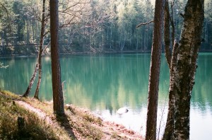 However, the tour won’t be perfect if we don’t see one of the most peculiar and mysterious lakes of Latvia – the lake Velnezers (Čertoks, Čortoks, Čertaks). The lake Velnezers is located ca. 250 m southwesterly-westwards from our finish. Not to be mistaken, we can go along a wood road that is by the margin of the lake Jazinks.
The lake Velnezers is a lake of suffosive origin. A crater depression is characteristic for it. Area of the lake is only 1,1 ha, but depth reaches 18,3 m! The water has small amount of salts so there aren’t many water-plants and water animals.
The lake Velnezers is one of the clearest lakes in Latvia that attracts with its peculiar blue-green water colour, big transparency and weird stories that from old times have twined the small lake. Water transparency in the lake is 12 m (according to other information – 8 m). The colour changes – the water can take all colours of the rainbow. This unusual feature can be explained with the fact that the water in the lake is very clear, it has no discharge and it has steep bank descents. If the banks were flat it would be more difficult to notice and appraise the beautiful colour of water.
In 1977 Čortoks lake nature restricted area was formed around the lake Velnezers with area of 55 ha. Several species of rare plants – sand pink, forest psque-flower, Dactylorhiza baltica and sweet butterfly orchid grow at the margins of the lake.
The lake and the restricted area are managed by AS „Latvijas valsts meži” that in cooperation with the University of Daugavpils have made a convenient sightseeing footpath.
At the end a reminder – you cannot swim in the lake in order not to facilitate its overgrowing and loss of the unusual colour!
The described span can be covered not hurrying in two days. More athletic water tourists can manage it in one day.


